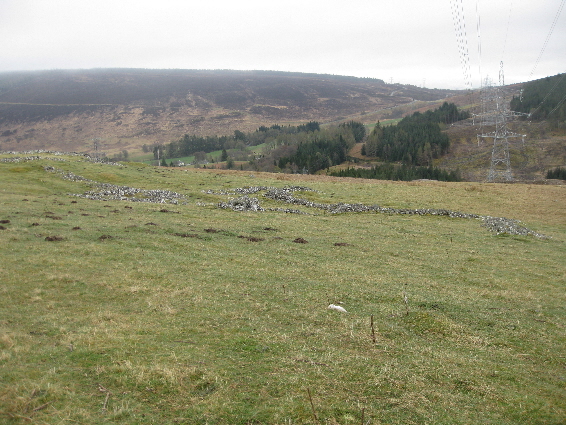
Auchdrumnahuagie is not identified on the 1st edition of the Ordnance Survey map (1867), which shows it merely as a sheep fank (sheep fold), but it is named on James Stobie's map of Perthshire (1783). The settlement consisted of an area of habitation and a sheep fank bordered by a head dyke, with a lime kiln beyond it.

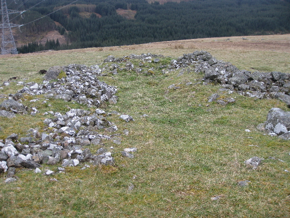
All that remains of the dwellings and out-buildings are the stone footings which have been constructed from rough, unworked, local stone with the use of mortar. The largest ruin was probably a house with stores or animal houses at either end, as shown by the remains of internal, stone, dividing walls.
Opposite, and at right-angles to the house, are the stone footings of a smaller building which was probably a store. The site is very open and exposed to the prevailing wind, so the walls joining these two buildings and entending round on the windward side might have afforded some protection.
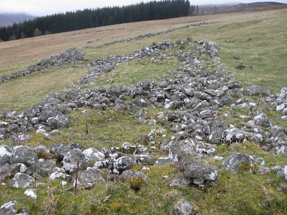
The sheep fank complex is to the east of the other buildings and is of a similar construction. It consists of a large enclosure on the western side and three smaller pens, for separating sheep, on the eastern side. The highest remaining section is not much more than a metre in height.
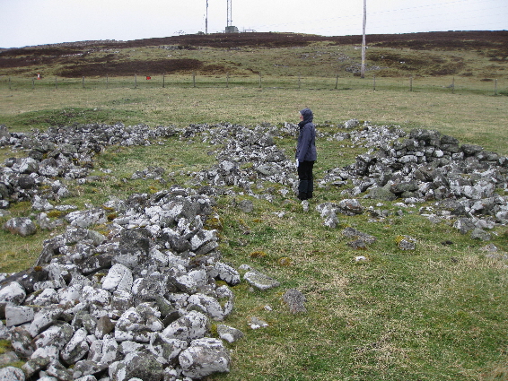
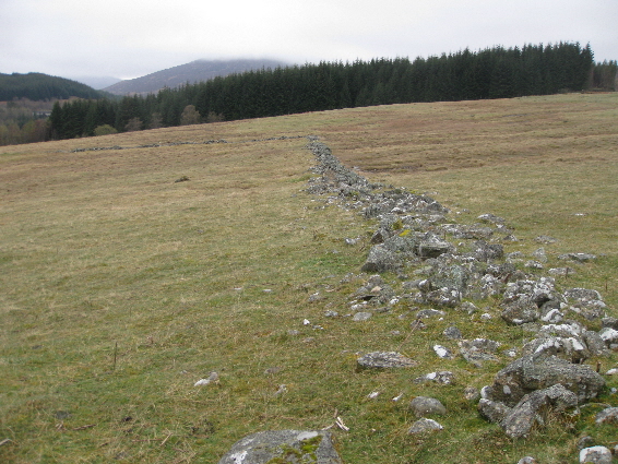
Originally there was a wall surrounding all of the settlement and adjacent pastures which went down to the Errochty Water. Despite a landrover track having been driven through the site, most of the walls and head dyke are still intact.
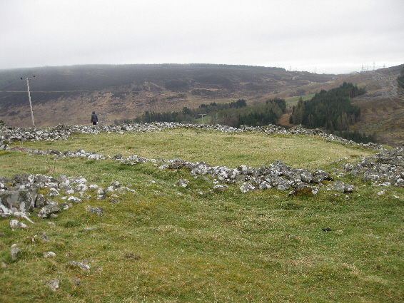
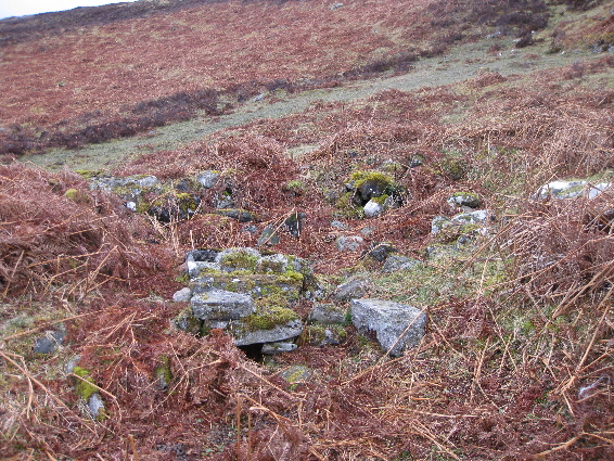
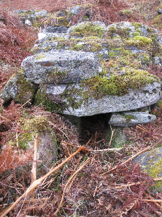
The lime kiln is situated to the north of the settlement, just below the limestone outcrop (NN 7234 6567). It is not shown on any of the maps and would be difficult to find in summer due to the amount of bracken growing around it. One perculiar feature is its shape. Normally lime kilns were built into embankments or slopes to retain the heat, but here it has been built in a flat, open, area and its shape is rectangular instead of round. The 1st edition of the Ordnance Survey map (1867) shows the site as having two square, unroofed, structures and it is possible that an unused building had been converted into a kiln. Interestingly the flue is still intect.
One of the earliest entries in the Old Parish Record (OPR) of Blair Atholl states that Alexander Robertson, in Auchdrumnahuagie, and Christian Robertson his wife had a daughter Margaret born 18th October 1718. The marriage and baptism entries in the OPR charts the succession of families living at Auchdrumnahuague: Donald McLean and Janet McGlashan in 1737; James Robertson and Elspeth McDonald, alias Mannich, in 1756; Alexander McIntosh and Catharine Robertson in 1775; and Duncan McGilliwie and Margaret McGilliwie in 1788. However, it seems that the settlement could only support one family and eventually the land was feued with that of Dalchalloch.
| Blair Atholl Marriages | Return to Home Page |
|---|