The homestead of Balchapel has a variety of different spellings: Balinchapel, Bailteapail, Balintafail and Chapelton.
It is widely assumed that at one time there was a place of worship close to this homestead, but there is no conclusive proof, either in the surviving ruins or in any document. However this belief may be true as the Borenich burial ground occupies the northerly part of the same knoll as the homestead. Tradition has it that the burial ground originally belonged to the Douglas family, and details are given in the "History of the Burial Ground" section of this web-site.
The census returns for Borenich show that Balchapel was being farmed right up until the 1850s. After that, the ground became incorporated into the tenancy of Borenich Farm, which replaced Croftcarnoch and several other holdings in the 1860s. At the same time, a small house was built between Borenich Farm and Balchapel which was used as a secondary dwelling for Borenich Farm. This new house was named Chapelton of Borenich, as the original Balchapel was now deserted and in ruins. The monument inscriptions in Struan churchyard which mention Chapelton of Borenich, are referring to this later building.
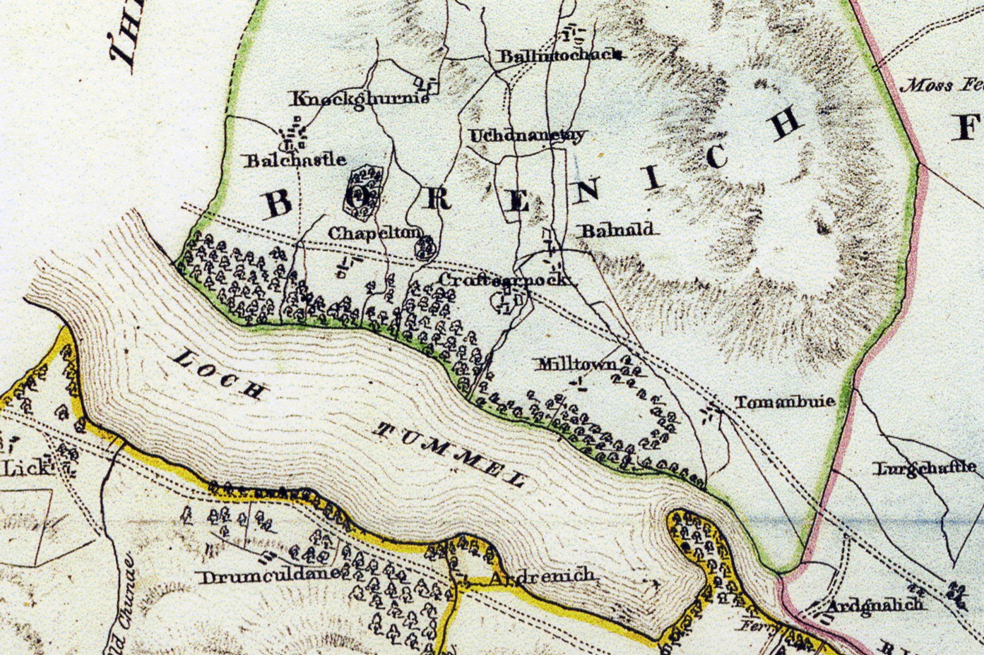
James Stobie's 1783 map names the homestead as "Balinchapel" and places it below Balcastle, but no chapel is shown and there is no road near to the homestead. John Thomson's map of Borenich, 1827, shows a road but he places Balchapel too far west. Finally, in 1832, John Waterston places Balchapel in the correct location and draws a track next to the homestead, leading eastwards below a hummock of trees which still exist today. This suggests that originally there was a track along the north side of Loch Tummel below the present-day road.
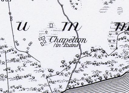
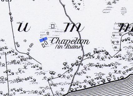
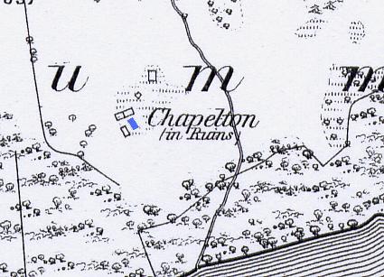
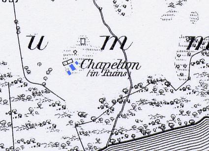
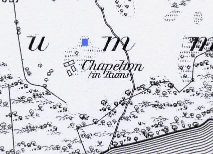
The Perth & Kinross Historic Environment Record (MPK8823) describes Balchapel as a farmstead comprising five unroofed buildings, which are annotated as "in Ruins", on the 1st edition of the OS 6-inch map (Perthshire 1867, sheet xxx). On the 2nd edition map (1906) a "burial ground" is first annotated with a track leading down to it from the road above.
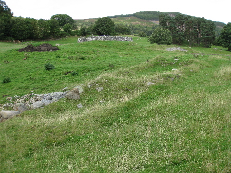
This map shows the footings of four buildings grouped together at the south end of the hummock, with the walls of the Borenich burial ground at the north end of the hummock, and the footing of a small outhouse in between. All of these structures still exist with the exception of the outhouse. In addition to these ruins there is evidence of two other buildings and some walled enclosures.
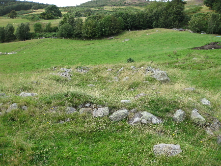
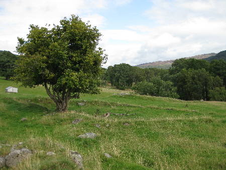
This view, in a north-easterly direction, shows the stone footings of an unusual structure. It was either two cruck-frame houses built in a semi-detached style, or else it was a very long cruck-frame house with a central partition.
The Borenich burial ground is in the background, and to the right of it is the hummock of old trees which were just above the original track, as previously mentioned.
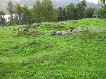
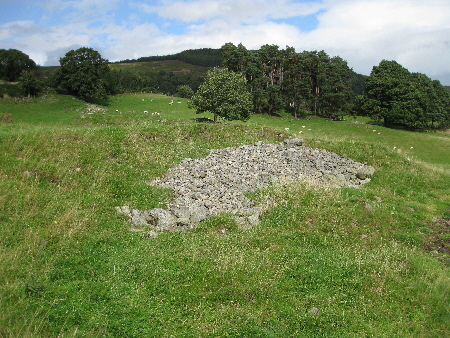
Next to the long house, and at right-angles to it, appears to be a third house. This view shows the remains of the stone footings of a cruck-frame house looking southwards towards Loch Tummel. The inhabitants would have had a fine view of the loch as Balchapel is perched on a prominent hummock with a steep slope behind it, down to the loch.
On either side of the third house appear to be some small outhouses used for storage. In this view looking in a south westerly direction, the footings of the third house are in the centre of the picture with the much smaller outhouse behind it, and the outline of another outhouse in the foreground. This last structure is not shown on the First Edition of O.S. map for Perthshire, 1867, but was almost certainly visible when the map was drawn up. This is not the only ommission - others have been found at Balcastle and Knockgarry.

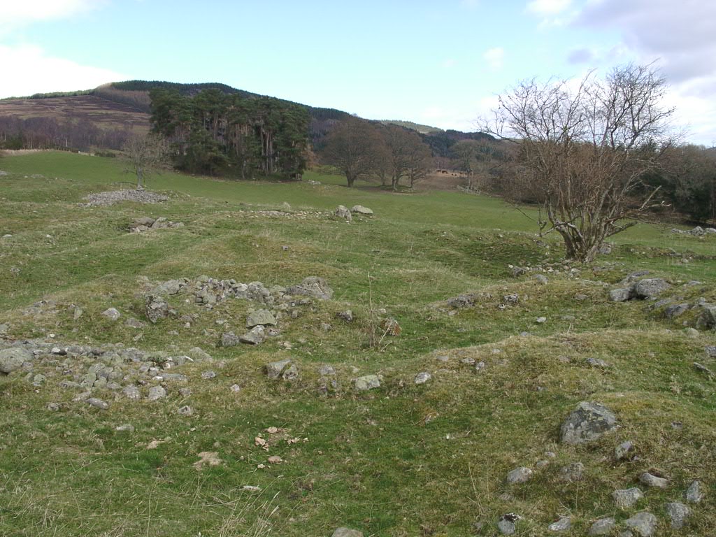
This view, in an eastery direction, shows an old hazel tree with an enclosure below it. The enclosure might have been used for penning animals, but it is more likely to have been used as a vegetable garden with a small wall to keep animals out. The hazel tree despite its age still produces a good crop of nuts, and its location suggests that it was planted here for that purpose. Hazel trees growing next to an enclosure can also be seen at Balcastle.

To the south side of the burial ground seems to be the footings of yet another long building, built into the slope. There is a degree of uncertainty, as no ruins are shown in this position on the First Edition of O.S. map for Perthshire, 1867. In addition, the site has been used as a dump for stones which were removed from the field when it was last ploughed, over twenty years ago.
Despite this, if these are the remains of another building, its size, distance from the other dwellings, and location next to the burial ground, might suggest that this was used as a place of worship.
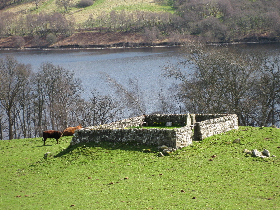
The final structure in this area is the Borenich burial ground itself, the history of which is given elsewhere on this web-site.
| Details of Borenich Homesteads | Stewart Births at Balchapel | Stewart Marriages | Return to Home Page |
|---|