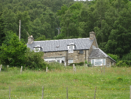
The homestead of Croftdouglas has a variety of different spellings: Croftdowglash, Croftindoulas, Croftindoulish, Croftindouglas. It is now a private house.
There is no clear evidence as to the origin of the name "Croftdouglas", but tradition has it that the Borenich Burial Ground adjacent to the homestead originally belonged to the Douglas family (details are given in the "History of the Burial Ground" section of this web-site). One of the earliest entries in the Old Parish Record for Blair Atholl mentions that Alexander Douglash and Isobel Stewart in Croftindoulas had a daughter baptised on 10th July 1720, named Katherine. Perhaps this, or his ancestors were the original Douglas family.
The "Chronicles of the Families of Atholl and Tullibardine" (appendices xvii and xviii) lists the Fencible Men of Strathtummel in 1706. It is likely that the list follows the Strathtummel dwellings from west to east as the first men mentioned are mainly Calmanachs (i.e. Dows) who were tenant farmers at the west end of the Duke of Atholl's property. Croftdouglas is on the easterly boundary, and just before the end of the list the Fencibles are: Alexander Douglas (armed); John Douglas (armed); Donald Douglas (wants arms); and James Douglas (armed). They follow each other and may be the same family or related families at Croftdouglas.
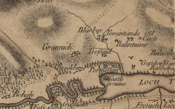
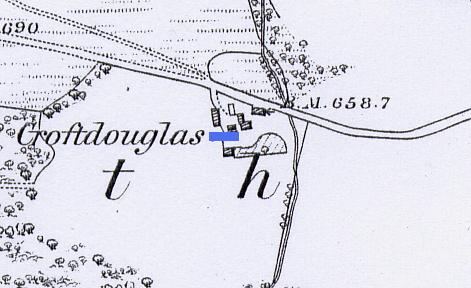
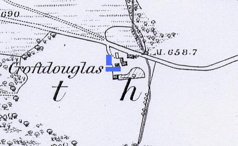
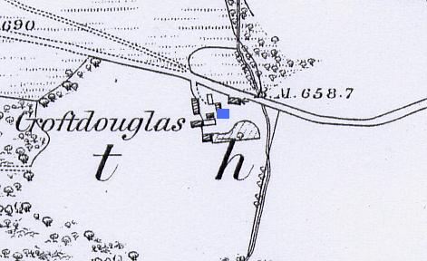
James Stobie's 1783 map names the homestead as "Croftdowglash" and places it below Balcastle, but no road is shown. John Thomson's map of Borenich, 1827, shows a road but he confuses Croftdouglas with Balnauld and places it too far west. So, it is not until the First Edition of O.S. map for Perthshire, 1867, that any reliable information about the dwellings is available.
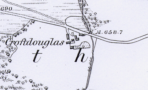
This map shows nine building, seven of them roofed, and an enclosure. The private house built beside the road has a bench-mark on its north face. The majority of these buildings still exist or have been rebuilt, but the most southerly building next to the enclosure no longer exists.
The 1841 census return shows that there were three families living at Croftdouglas. John Stewart, a tenant farmer, was living with his family in one dwelling. Isabella Stewart and two children were living in a second. Margaret Robertson, two children and Mary McMillan, probably a domestic servant, were living in the third. One dwelling was probably up by the road, whilst the other two dwellings were at the south of the homestead.
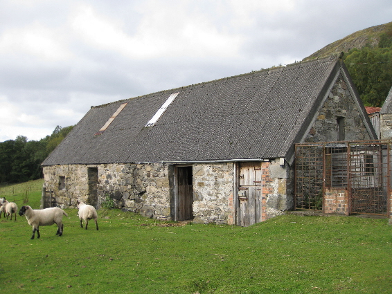
The small window at the west end of this building appears to be original, and suggests that this formed two ajoined dwellings. The 1867 O.S. map shows that the east section was no longer roofed, and the 1861 census shows that only two dwellings were in habitation.
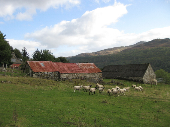
On the west side of the homestead there are two building running north-south, which might have been used as a byre and hay-loft. The upper building has a small door on its north face, with a earth ramp outside. This clever use of the natural incline of the property would have made it easy to bring straw and hay into the building. The south end of the lower building has some massive stones forming part of the foundation, and it is quite likely that these formed part of an even earlier structure.
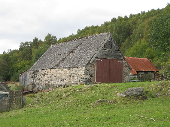
The similarities of style suggest that this inner building was repaired and re-roofed at the same time as the two dwellings at the south.
| Details of Borenich Homesteads | Stewart Births at Croftdouglas | Stewart Marriages | Return to Home Page |
|---|