
Up until 1700 this property was called Rienaletrick, but after that it was known as either Breac-ruidh or Woodsheal. The name of Woodsheal is
synonymous with Donald Robertson, the son of Robert 'Ban' Robertson of Miltown of Invervack. Donald Robertson of Woodsheal led the Robertson
clan for the elderly Alexander Robertson of Struan during the 1745 Jacobite Rising, and was left for dead on the battlefield of Culloden. He
survived, escaped to France, and eventually returned to Blair Atholl parish a few years before he died. It is uncertain whether he actually
lived at Woodsheal, as the property was held as a wadsett (security on a loan), but there is evidence that the tenants paid their rents to
his father, who presumably had ways and means of forwarding it to his son in France.
As Woodsheal was part of the Forfeited Estates, it was included in the 1756 census which detailed the families and their settlement. The three
tenants were Duncan Robertson senior, Duncan Robertson junior and Patrick Robertson. The terms 'senior' and 'junior' merely denoted their
respective aged and did not imply that they were father and son.
The household of Duncan Robertson senior was comprised of two females over the age of 17 and a boy aged between 10 and 17. None of them could
speak English, but the two women could spin. He owned 9 horses, 16 black cattle and 74 sheep, but no pigs nor goats. 2¼ acres were being
ploughed and a small quantity of flax was being gown, but no potatoes nor hay.
Duncan Robertson junior can be identified from the Blair Atholl OPRs. He was Duncan Robertson junior who came from Crombruach and was married
to Christian Robertson from Wester Blairfettie. Their daughter Janet was born 1752 and this matches the 1756 census. Either he or his wife
could speak English and she could spin. He had very little livestock, 4 horses and 6 black cattle, but had 2¼ acres of tilled land. By 1758,
he and his family had moved to Calvine.
The third tenant, Patrick Robertson can also be identified. Originally from Aonach of Auchleeks, he married Isabel Robertson from Kinaldy in
June 1751. The 1756 census shows that they had two children: Aemily, born May 1752; and Alexander, born September 1754. None of them could
speak English, but Isabel could spin. Their livestock consisted of 4 horses, 3 black cattle and 18 sheep. They paid less rent than the other
two tenants and had only 1½ acres of ploughed land and grew a little flax. The rest of the crop was probably barley and oats. The family moved
across the river to Achleanie by 1762 by which time they had 5 children.
Woodsheal is situated beside the Allt Coire Leathanaidh on a small dry grassy ridge, slightly above the rest of the sloping ground. Even now the green grass covering the fields above the settlement form a stark contrast with the heather beyond the head-dyke. To the north, the terrain slopes down to the river Garry and beyond that the Wade road from Perth to Inverness.
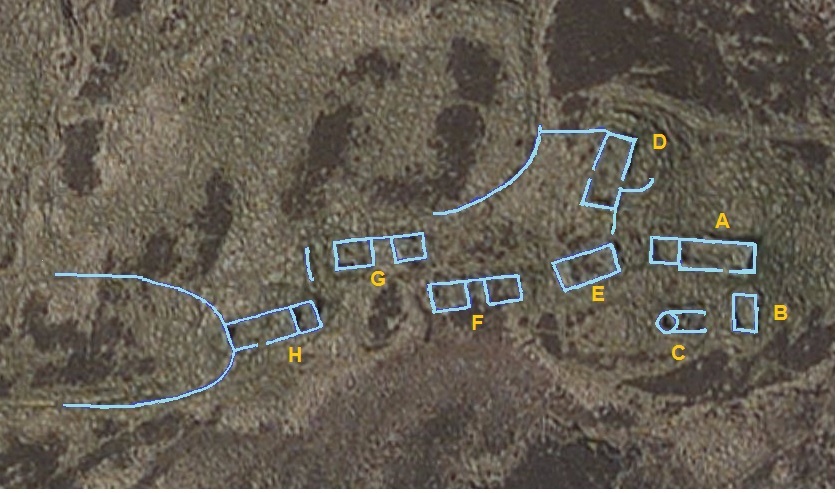
The track up to Woodsheal crosses the Garry at the Achleanie ford and enters the settlement between buildings A and D
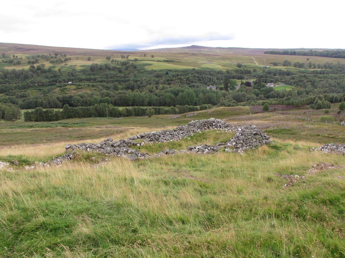
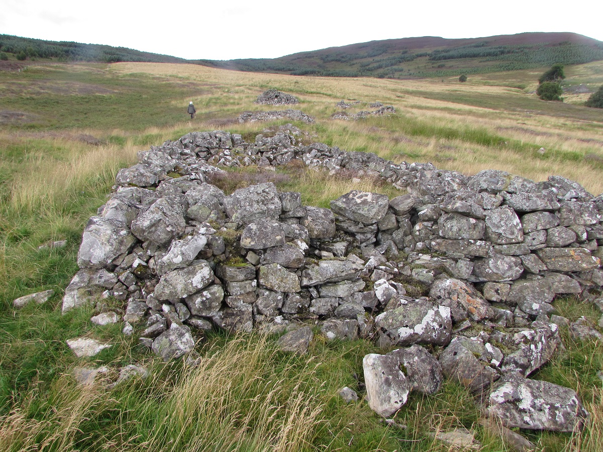
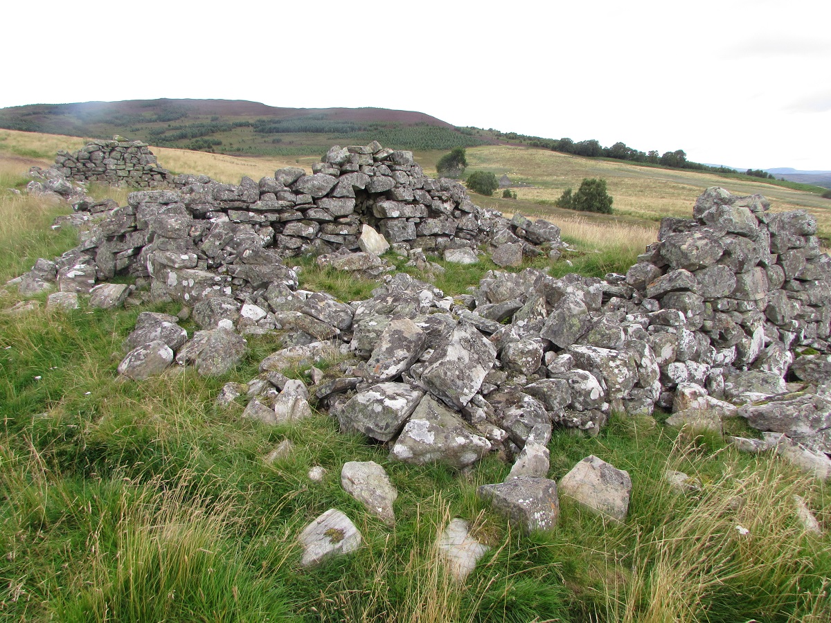
Building A is one of the three houses in the settlement (each tenant had his own house). The construction, like the rest of this site, is of rough, undressed stone probably from field clearance, without the use of lime mortar. The remaining ruins are more substantial than stone footings, with a doorway facing southwards, but no indication of internal compartments, fireplaces or windows. An attached shed to the west may have been built at a later date as its width is less than that of the house, which is unusual.

Building B is probably a store as its size is smaller than the footprint of a typical house. It is also orientated north-south, instead of east-west, so very little light would have come in through the doorway which must have been on the west side as the ground slopes away to the east.
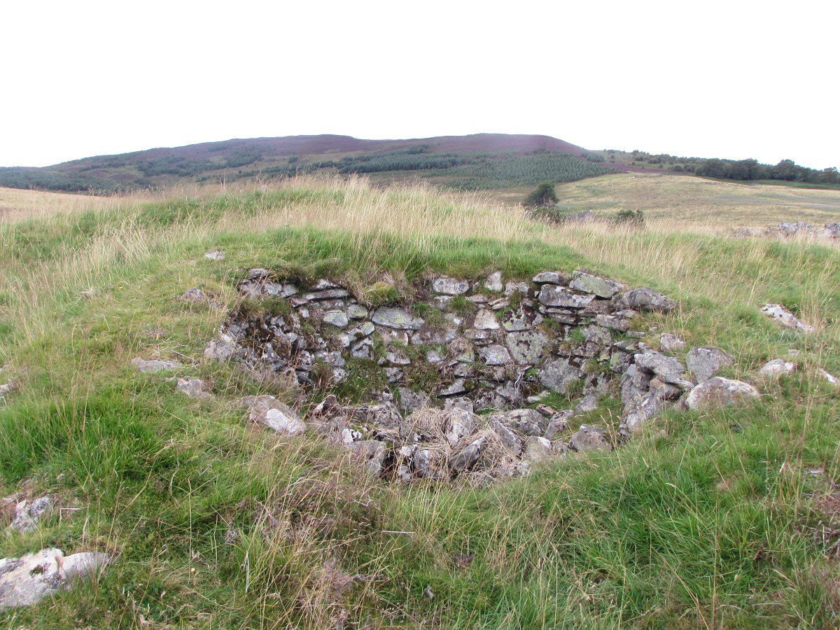
Alongside building B there is a corn-drying kiln and kiln barn (building C) built into the slope of the ridge. The bowl in intact, although the flue is obscured by some rocks which have fallen in. The jumble of stones in front of the kiln bowl show that originally there must have been a substantial kiln barn, covering the kiln itself and providing a dry working area in front.
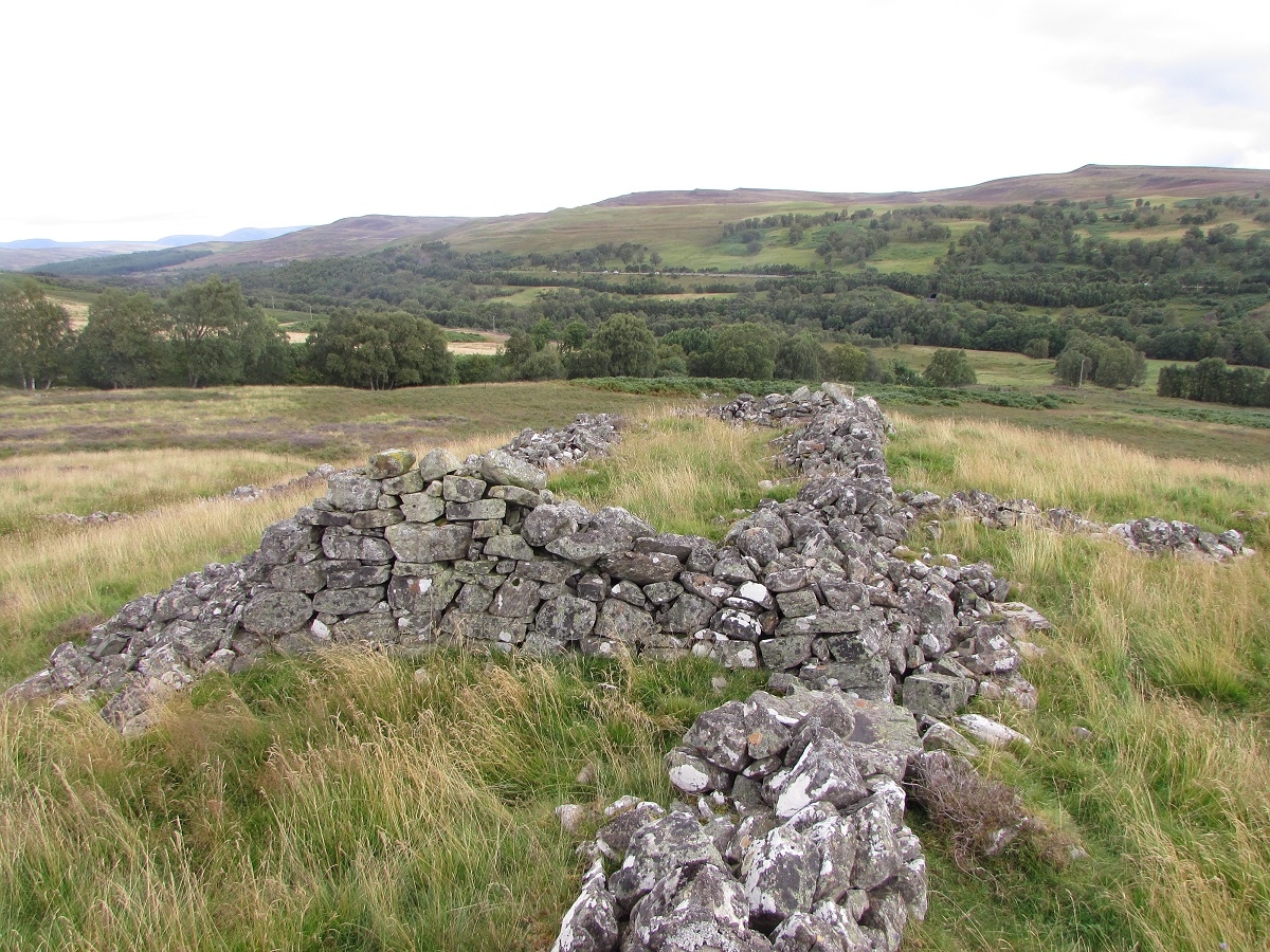

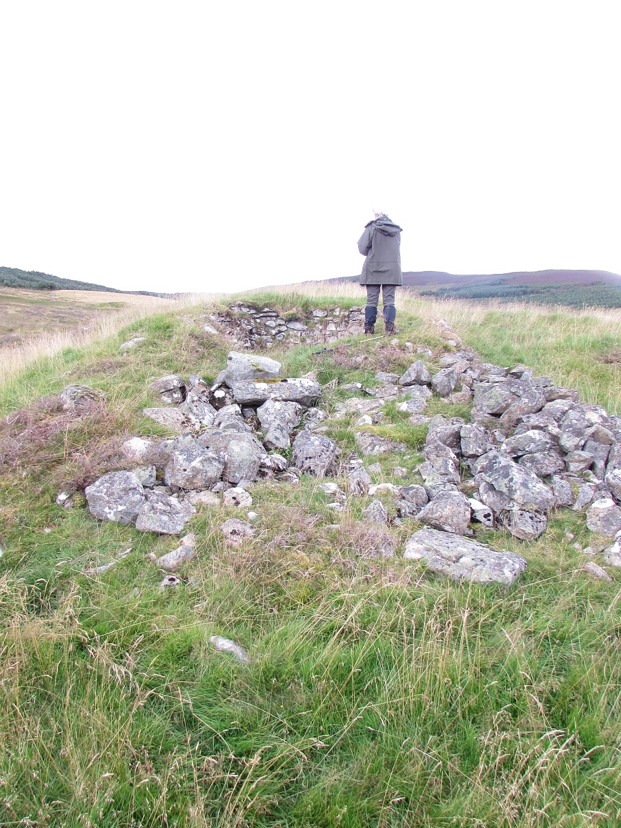
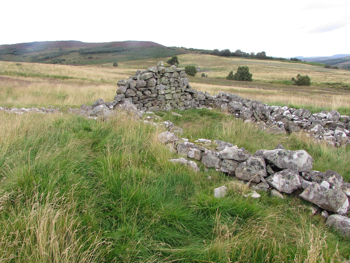
Building D is the size of a large house with enclosure walls joining at both ends. There is also a short curved wall joining on the east side which
follows the line of the track into the settlement from the Achleanie ford. The building is orientated north-south, so it is unlikely to be a house,
and has a doorway on the west side and another oopposite it on the east side, close to the short curved wall. The presence of these two doors
opposite each other, to produce a through draught, suggests that this was a winnowing barn.
The winnower stood between the two open doors throwing the seed which was being cleaned into the air. The breeze blew the light chaff away, while
the heavier seed fell back into the winnowers pan.
From its size and orientation, building E is probably a second house. To the north, between this house and the winnowing barn, the 1st edition O.S. map for Perthshire shows an irregular shaped enclosure bounded by stone dykes. In reality buildings F and G are incorporated into this small enclosure.


Building F forms part of the enclosure to the west of the second house. It appears to be made up of two small stores, separated by a grassy area, with a stone dyke between the stores. This stone dyke may be just part of the enclosure. Alternatively, it could be the back wall of an open-fronted barn where a cart might be kept. Equally well, it could have been a peat store or a midden.
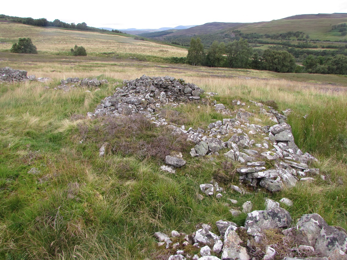
Building G forms the north west part of the enclosure, and appears to be similar to building F.
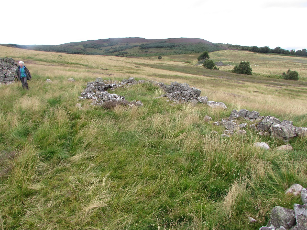
Building H is the third house at Woodsheal. It is orientated east-west, with a doorway on the south side and an attached shed on the east side.
The building had stone gable ends and an equally high partition wall between the dwelling and the attached shed. Although this partition wall
appears to have a fireplace, this is just the result of stone slippage over time. There are no indications of a fireplace, nor windows.
Two stone dykes run westwards from the end of the house and these seem to have been part of a large enclosure between the settlement and the
Allt Coire Leathanaidh.
| Blair Atholl Marriages | Return to Home Page |
|---|