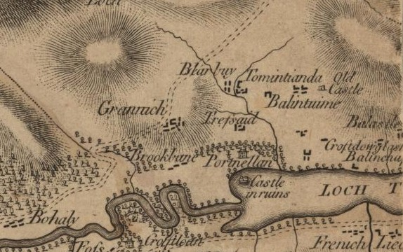
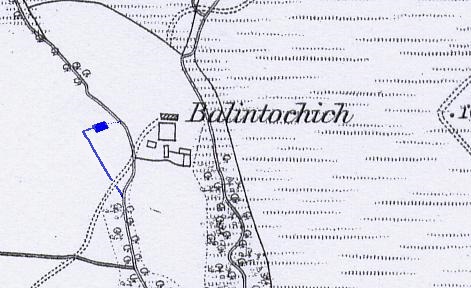
In early documents, the name of this homestead was written as Balintockish and Ballintochick. James Stobie called it Balinloch when he was producing his map of Borenich in 1783, and John Thomson copied this name for his 1827 map of the area. In 1832 John Waterston used the name Ballintochach, but by the time of the first census in 1841 the accepted spelling seems to have become Balintochich.
The first time that Balintochich is mentioned in the Blair Atholl OPR is 3rd March 1785, which is for the baptism of Donald Stewart, the son of Patrick Stewart and Helen Stewart in Balintochich. Their second son, John, was also born at Balintochich and baptised on 21st August 1787, but there is no further mention of the family. Neither is it known whether Patrick Stewart was living at Balintochich when he married Helen Stewart as, between 14th December 1781 and 26th August 1784, there are no marriage entries in the Blair Atholl OPR. As there is no record of such a marriage in any of the adjacent parishes, it must be assumed that both parties were already living in Blair Atholl parish.
The first marriage associated with Balintochich is that of Henry Stewart in Balintochich and Ann Douglas in Logierait parish, dated 23rd November 1786. As this date is between the births of Donald and John, then Henry must have been living in Balintochich, along with Patrick Stewart and his wife Helen. It is highly likely that Henry was the son of Alexander Stewart and Cicel Stewart, born 11th September 1753, as his eldest son was named Alexander and his second eldest daughter was named Cicilia (ScotlandsPeople indexes it as Sissal for some unknown reason), as would be expected by the traditional naming pattern. Henry did have a brother Patrick but it seems unlikely that this is the same one, as Henry's brother was nine years his junior.
The lack of records before 1785 suggests that Balintochich dates from the early 1780s, and was a new piece of agricultural ground being offered for lease to accommodate an expanding local population.
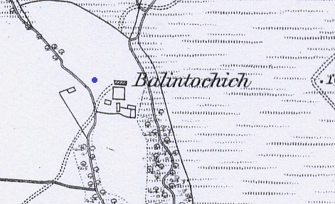
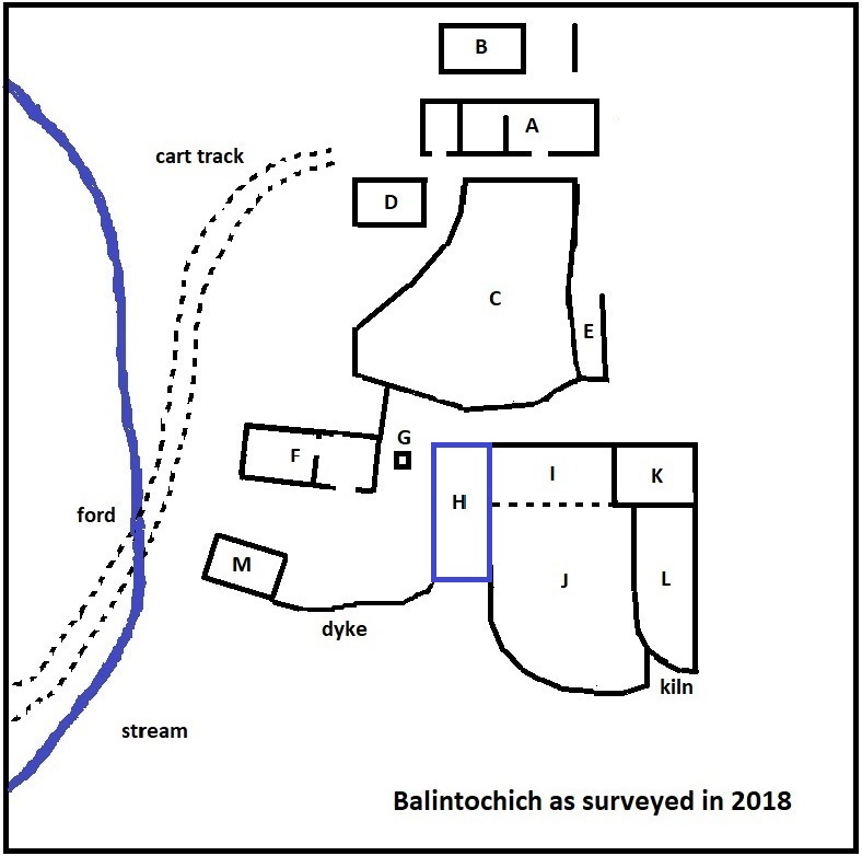
The Perth & Kinross Historic Environment Record for Balintochich (MPK 1240), describes the site as "a corn drying kiln, farmstead, township, storehouse and dykehead. Possible medieval antecedents, visible as a series of stone foundations of ruined buildings, and grassed-over mounds and banks. The monument lies in an area of rough pasture at c280m OD, c550m NNW of Borenich Farm. OS Grid Ref: NN 8369 6064".
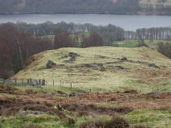
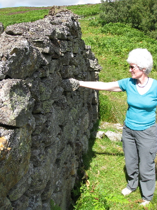
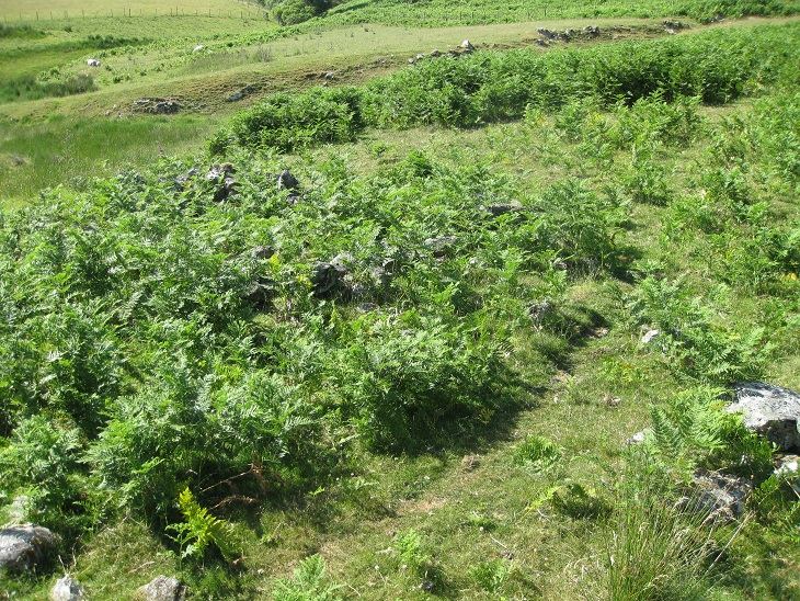
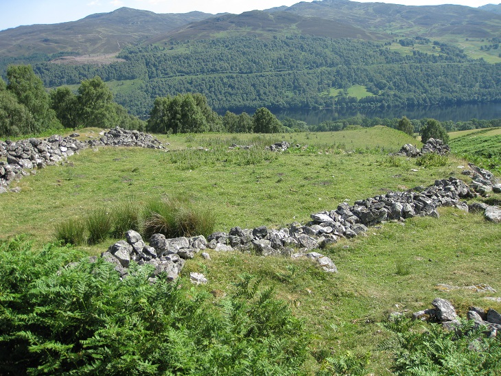
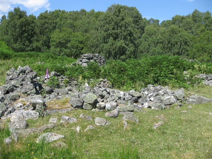
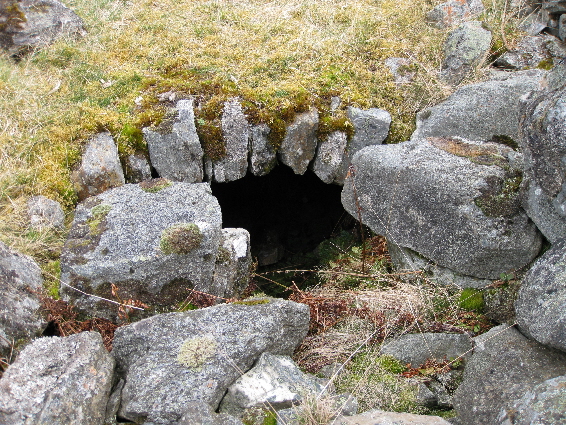
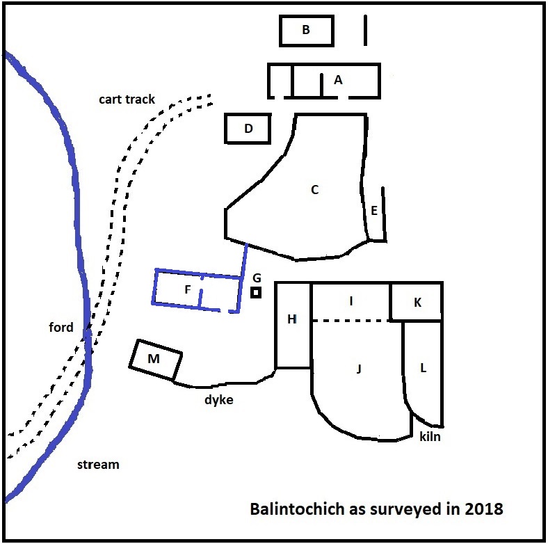
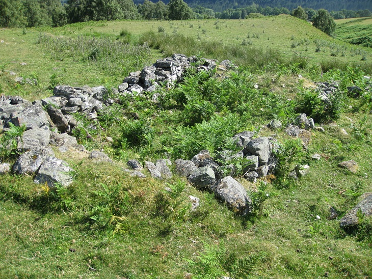
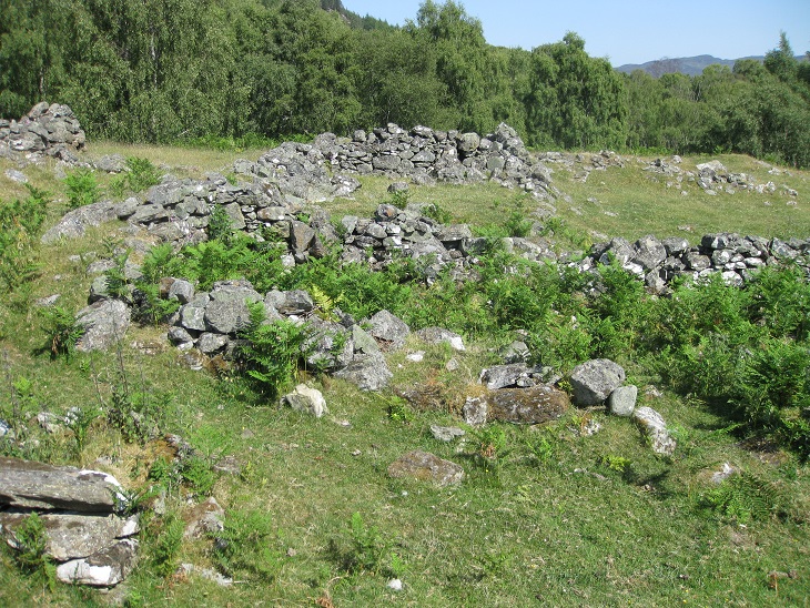
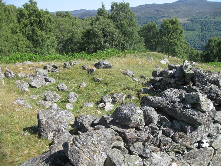
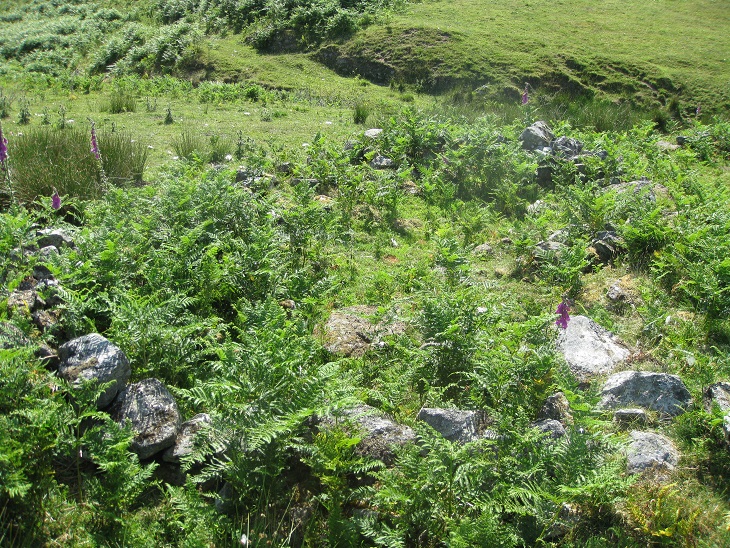
The homestead is situated on the hillside, just to the north of the Strathtummel road, above the present-day Borenich Farm (O.S. Grid Ref: NN 8369 6064), and the remains of a track can be seen above the head dyke which almost certainly connected Balintochich by the hill road over to Struan and Blair Atholl. As can be seen from the photograph above, the location is quite exposed, with the remains of the buildings on a ridge of rough meadow between two streams. The Allt Borenich to the east forms a deep gorge making access from that direction difficult, and access was by a cart track leading up from Knockgarry.
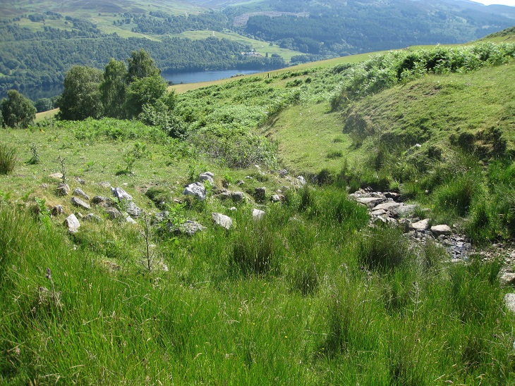
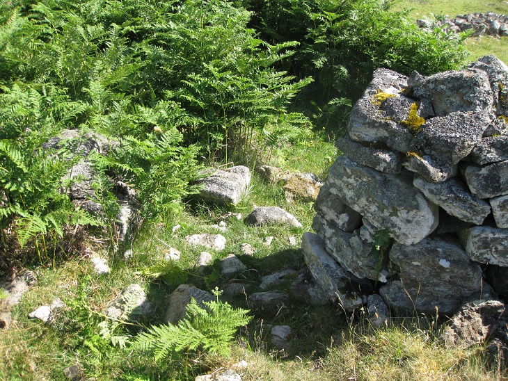
The track to Balintochich has been cut into the hillside which slopes down from the west, with the banking faced in stone to prevent soil erosion. The track passes through the west enclosure before it dips down to cross the stream at a relatively even area, where large flat stones have been laid to form a ford.
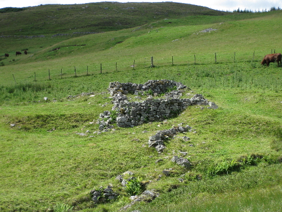
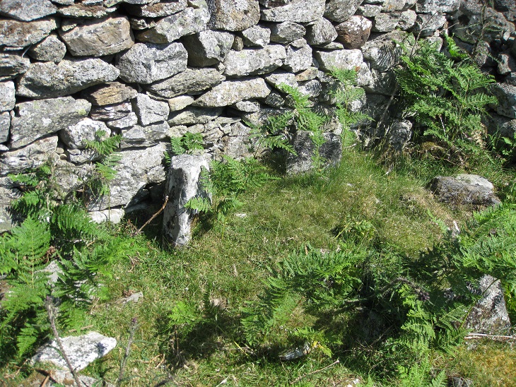
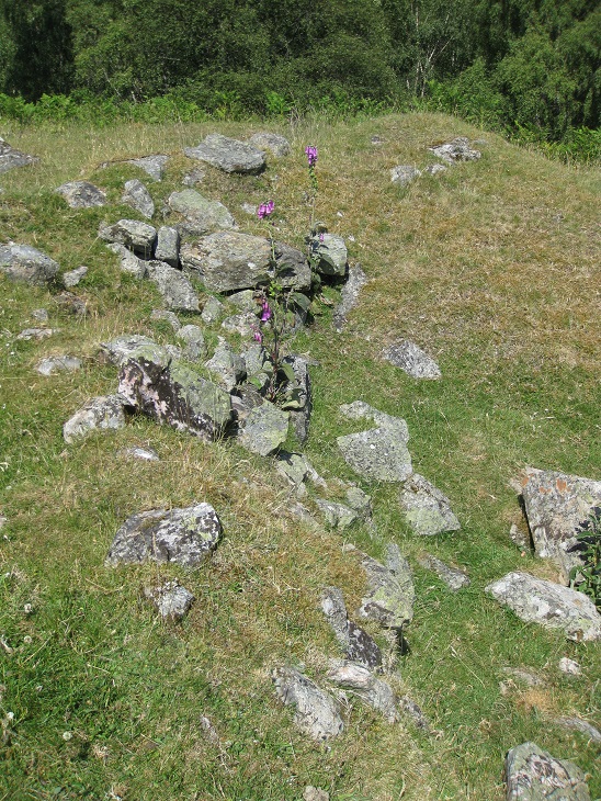
A peculiarity of this site is that one of the houses appears to be separated from the rest of the settlement by the stream.
The unmortared stone footings of the house measures 10 metres by 5 metres, and the building probably had two rooms separated by an internal stone wall. The doorway was on the south side, but there is no evidence of a chimney. The ground to the south of the house appears to have been an enclosure, formed by a stone wall to the north and west, with the stream entering a ravine protecting its eastern flank. However, this depends on how far west was being farmed by Balintochich, and how much of that ground was farmed by Uchdnantaig and Knockgarry. Certainly the documentary evidence suggest that a single family farmed Balintochich with another family hired as farm servants, and possibly an artisan (e.g. weaver) in a third house which might have had a pendicle of land, like the separated house.
By 1841 there were three families living at Balintochich. Donald Douglas, an agricultural labourer, and his wife Catrine Stewart with three young children. By 1849 the family had moved to Bohespic, where Duncan Douglas the shoemaker (1849-1924) was born. In the History of Borenich Burial Ground it is related that the ancestors of Duncan Douglas 'owned' the burial ground next to Balchapel. The second family consisted of Donald Stewart, a cottager, his wife Jannet and their son Alexander who was another agricultural labourer. The third family was that of Alexander Stewart, a hand-loom weaver, his wife Margaret Stewart, and their two infant children.
By 1851 there were only two houses being occupied. Alexander Stewart, the weaver, his wife and six children were in one house, while the other house was occupied by Jean Stewart who was looking after two young people called McDonald. The census records them as "idiot paupers", but they were probably just a bit simple-minded and unable to support themselves.
Alexander Kennedy was living at Balintochich when he married Susan Stewart in Balintuim, on 5th December 1854. She, probably, was the widow of William Dow of Balintuim.
Alexander Kennedy and his wife might still have been living at Balintochich in 1861, as the census records that the inhabitants of one of the two occupied houses were absent. The other house was being used by John Stewart, master tailor, and his family. John Stewart was married to Janet Kennedy, and a John Kennedy, journeyman tailor, was living with them, who may have been related.
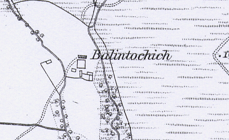
When the site was first surveyed in 1867 there was only one building being used, but this could not have been by John Stewart, as the family moved to the parish of Moulin after the birth of his son Duncan in 1863. Perhaps Alexander Kennedy was still in residence, or perhaps a new tenant had taken over the buildings. Whoever it was, they had left by 1871, and in 1891 the census enumerator recorded the homestead as being in ruins.
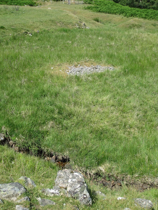
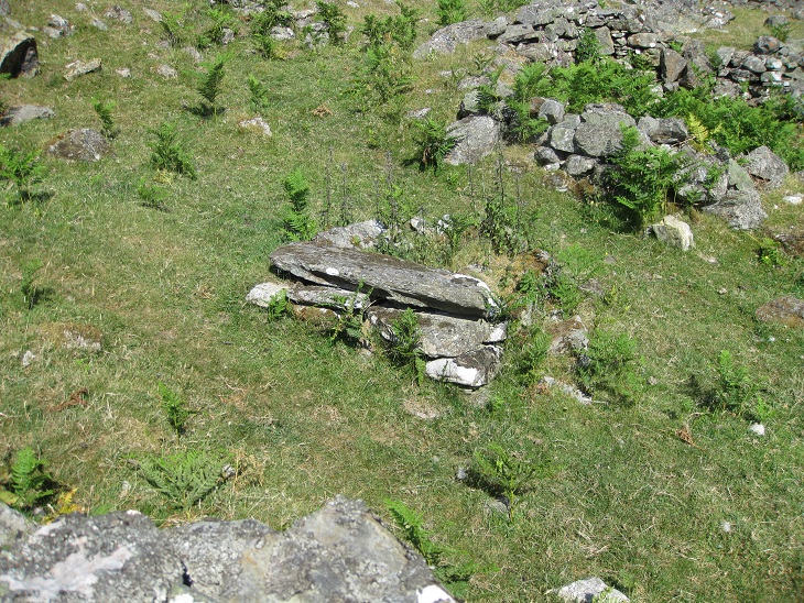
The track leading up from the ford to the main ruins passes a small, roughly circular, area about 2 metres across covered with small stones. Normally pile of stones are field clearance from ploughed land, but in this case all of the stones are of a similar small size, not a mixture of large and small. One possible explanation is that the stones were a base used to kept a hayrick dry, but as the site is very close to the stream it is more likely to have been a drying area for wash-day.
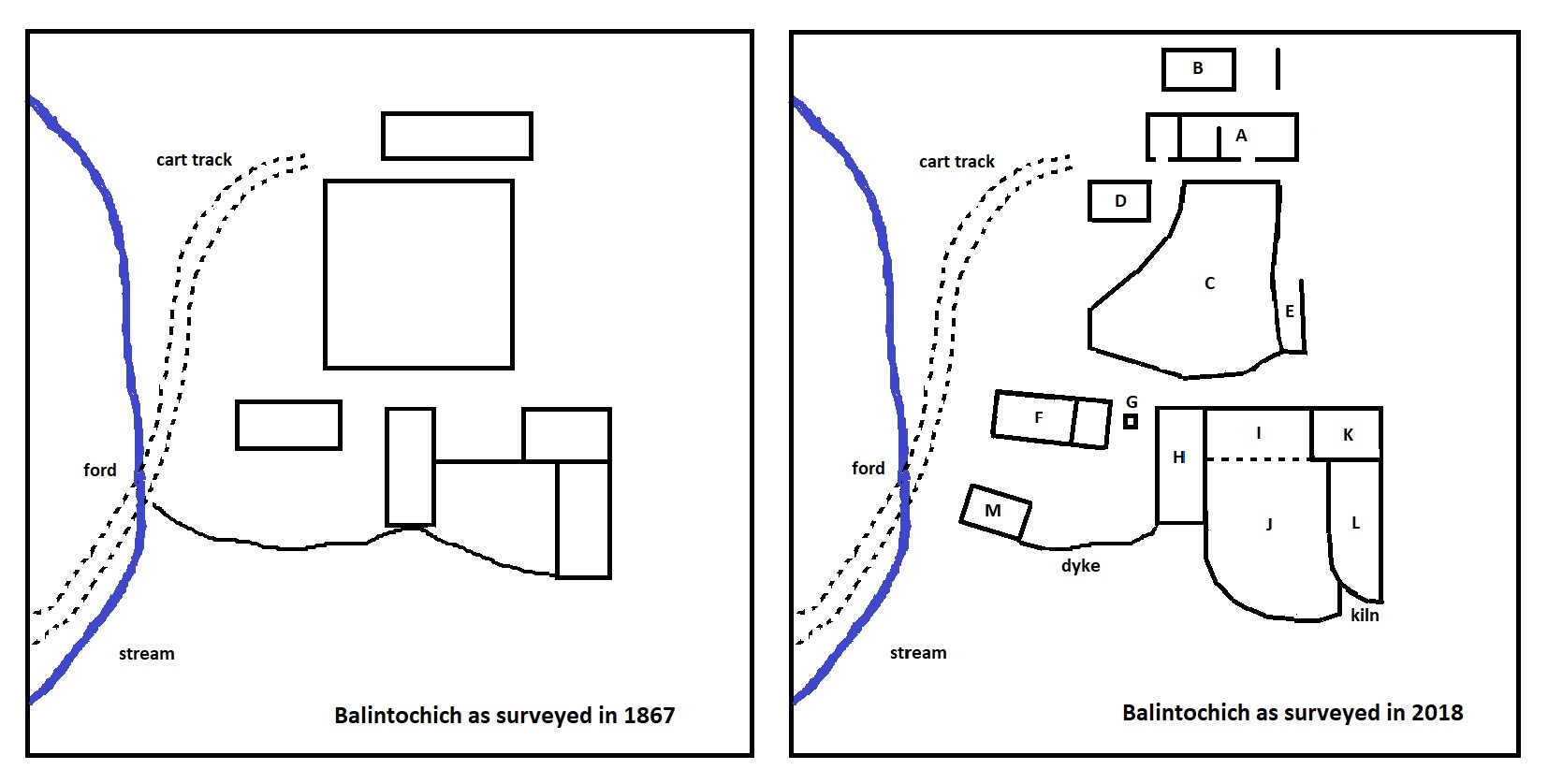
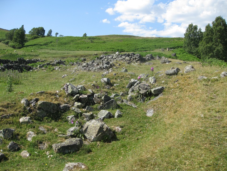
All of the structures described so far are consistant with the 1867 O.S. map of Balintochich, but O.S. plan of the main settlement has numerous inconsistances when compared to the present day ruins. This is unexpected considering that the whole settlement was abandoned soon after 1867 and that the last inhabitant probably was a tailor and not a farmer, who may have made alterations. It is known that some of the other settlements in the area were not accurately surveyed, as the surveying team was behind schedule and being urged to work faster. In such circumstances they may well have just recorded the main buildings and ignored bracken covered ruins.
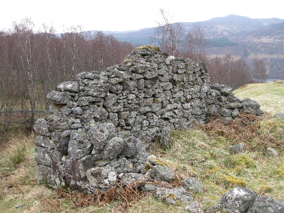
At the top of the track from the ford are the ruins of the last house to be inhabited. The building measures approximately 16 metres by 5 metres, and was constructed with rough stones held together by a mortar of river sand, mud and straw, rather than lime mortar. Once the thatched roof collapsed, wind and rain removed the mortar giving the impression that the stones had been un-mortared. It was comprised of a two roomed house joined to a small external store at the western end. The two rooms were separated by a stone partition, but the floor level at the west end is much lower than at the east end. In fact it appears to have collapsed in and is soaking wet between the fallen rock, rather like a sump, which may be significant. The east gable is still intact to a height of 2 metres, as measured from the outside, and the entrance to the house was on the sunny south side, about 6.3 metres from the east gable.
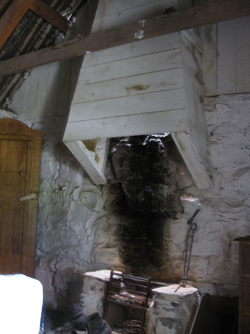
There are two upright stones inside the house below the east gable and these seem be the remains of a 'hanging lum' fireplace. Prior to this, the fireplace would have been an open hearth in the middle of the room. By the mid-1800s the chimney tended to be built into the gable end.
The doorway to the outside store is about 1 metre wide, and situated just 1.7 metres from the west gable end.
When the ruin was first visited in the early 1980s, there was still a trace of heather thatch on the gable end, but this has now disappeared. On the outside of the gable wall there are two protruding stones which were probably used to help tie down the roof. This is a substantial ruin compared to the stone footings of the other buildings which surrounded it.
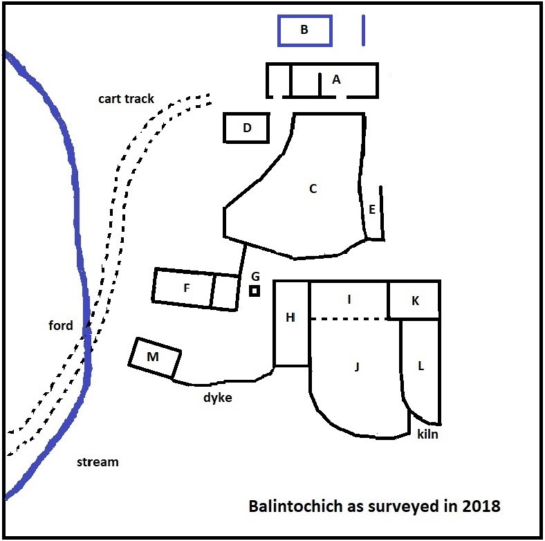
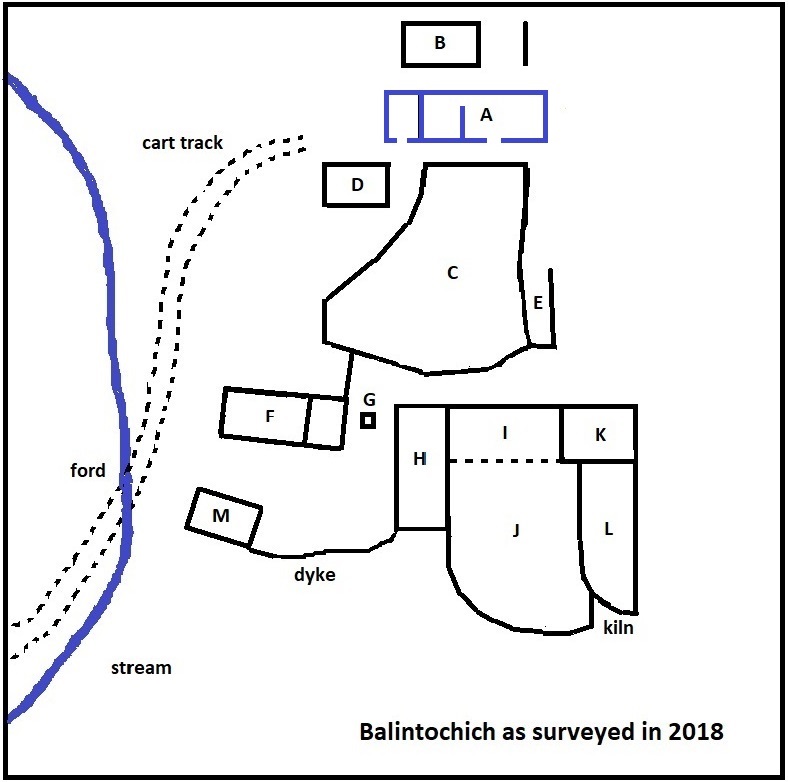
Directly behind the main house are the footings of another building not shown on the 1st Edition of the Ordnance Survey (1867). Either it was built after that date, which seems unlikely, or else the footings were covered with bracken and ignored. The building measures 6.4 metres by 4.4 metres and probably was a workshop or store, rather than a dwelling. There is also the remains of another stone footing just to the east, forming a single stone wall which does not appear to connect with the rest of the building. So the building could have been in two parts with an open-sided workshop or threshing barn at the eastern end.
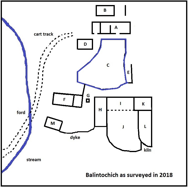
In front of the ruins of the main house is an un-mortared stone wall enclosure which is shown as rectangular on the 1867 O.S. map. This may be another simplification made by the surveyor or, possibly, building D was erected at the north-west corner of the enclosure, and the west wall was re-aligned.
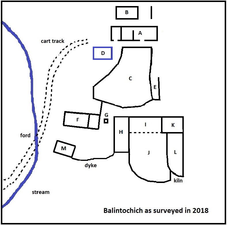
The relatively small size of this building suggests that it was used as a store or workshop, rather than as a house.
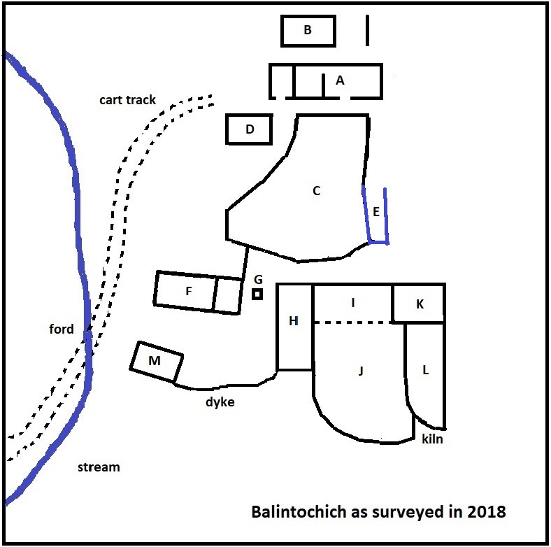
Another structure missing from the 1867 O.S. map is a construction built against the eastern wall of the enclosure. Although it has been suggested that this was a house, evidence would suggest otherwise, and it is mose likely to have been an animal pen or a midden. The pen is about 4 metres wide and 12.8 metres in length, with an entrance at the northern end and the southern end being continuous with the southern wall of the enclosure. In contrast a typical house would be 5 metres wide, orientated east-west to take advantage of the sunshine, and would not have an entrance in a gable end.
The pen is unremarkable, except that at its southern end there is a small hidden vault, and some confusion probably has arisen by associating this vault with a description in Hugh Mitchell's 'Pitlochry District', (1923).
"Not far from Fincastle and about half a mile above the farmhouse of Borenich there is an extensive group of ruins on the side of a small burn. They include the remains of a fair sized dwelling house on the top of the bank and part of the walls are still standing. Inside the house and at the side of what was the fireplace, there is a small square hole in the floor which gives access to an underground vault, extending the whole length of the building. Its height does not exceed four feet, owing to the accumulation of earth, which may conceal the secret exit. The vaulting is a very fine example of of masonry and is of such small stones shaped like bricks and so carefully set that not one has moved. It is similar to the vaulting so much admired in the Chancel of St. Giles Church in Edinburgh, and if of the same period would be about 1450. The history and name of the ruins are unknown, but the estate belonged to the Stewarts of Fincastle, and it may have been the original mansion house before Fincastle was built."
From the description of the location, this extract must be referring to Balintochich. It is possible that Hugh Mitchell had come across an earlier reference to a vault in the 'People's Journal' 17th April 1897, and investigated the ruins himself.
"On the farm of Borenich, on the north side of the loch, there are the two upright stones of a cromlech, or Druid's alter, the ruins of Balnacaistel, an underground arched chamber, and an ancient Caledonian fort, all within a radius of quarter of a mile."
Unfortunately, although the article provides further details for Balnacaistel and the ancient Caledonian fort, it tantalisingly reveals nothing more about the underground arched chamber.
Although Historic Environment Scotland (formerly RCAHMS) seem happy to identify the vault as 'a potato clamp', it would be useless for storing potatoes over winter. Alec Barbour of Fincastle said that when the hidden chamber was uncovered, many years ago, it contained parts of an old whisky still, and this probably was its true purpose. Illicit distilling was rife in this area and the Excise Men were extremely vigilant, so building a hiding place beneath a midden or a pig-pen would seem a wise precaution.
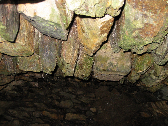
However, this structure still does not tally with Hugh Mitchell's description. Firstly, this is not under a house. Secondly there is no evidence of a fireplace and even if there was, there would be no room for a small square access hole beside it. Thirdly this secret vault does not extend much more than a metre, and the description that it extended the whole length of the building implies a much greater distance.
The obvious conclusion must be that a different hidden vault is being described, and a mason who can build one vault could easily build a another one. It is pure conjecture, but everything points to there being another vault beneath the main house (A).
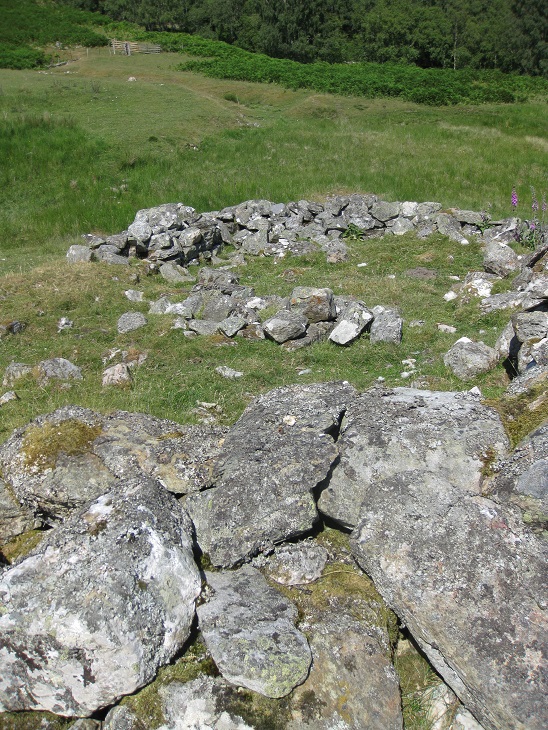
A small wall runs southwards from the enclosure, downhill and joins building F. This structure has been built into the slope so that there is a small grassy plateau between it and the enclosure. This would seem to be another south-facing, two-roomed, house measuring about 12 metres by 5 metres. This would give a total of three houses and it is known that three families had been living at Balintochich from time to time. The next range of buildings (H to K) is just to the east of house F, but between them is, what can only be termed 'an oddity'.
In the centre of the grassy slope which runs down between house F and building H, there is a small square stone structure measuring about 1 meter by 1 metre. An initial response would be to say that this has been built as a seat in recent times, but a closer inspection suggests that it dates from the same period of time as the rest of Balintochich. The stones have been arranged so that the surface of the structure is level. The top seems to have been constructed using two long thin slabs, one of which has slipped from its original position.
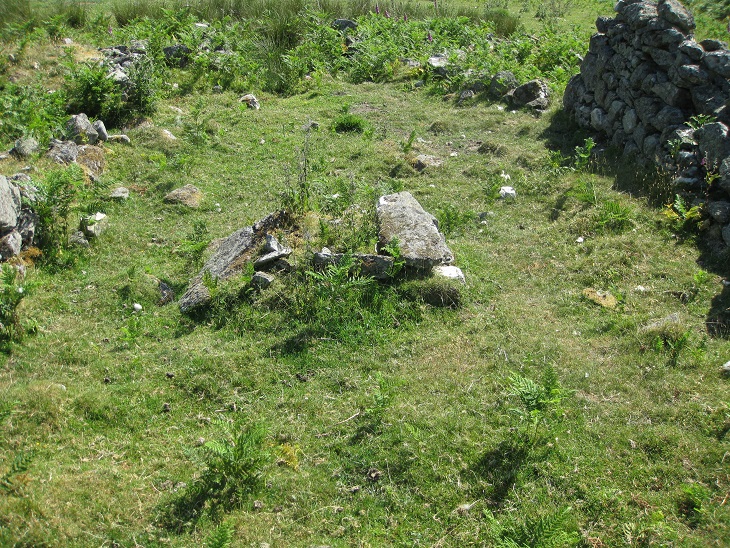
The use of two such stones to finish off the top indicates a need for stability, and providing a level surface on a slope suggests that the structure may have been the support for a wooden ramp to load carts. Certainly it would have been easy for a loaded cart to turn below house F before crossing the ford.
Building H is about the size of a house, 12 metres by 5 metres, but is unlikely to been used for this purpose. Firstly it is orientated north-south,
so that it would have been not so light inside. Secondly, being built down a slope, it would have been uncomfortable to live in, unless the floor
had been levelled in some way.
One possibility is that it was a winnowing barn, but the ruins give no supporting evidence. A winnowing barn should have a door on the
west side, for the prevailing wind, and another door or window on the opposite side to produce the through draft. Winnowing barns tended to be
quite large as they provided storage space for the sacks of grain waiting to be taken to the corn-mill. Significantly the structure which might
be a loading ramp is right next to this building.
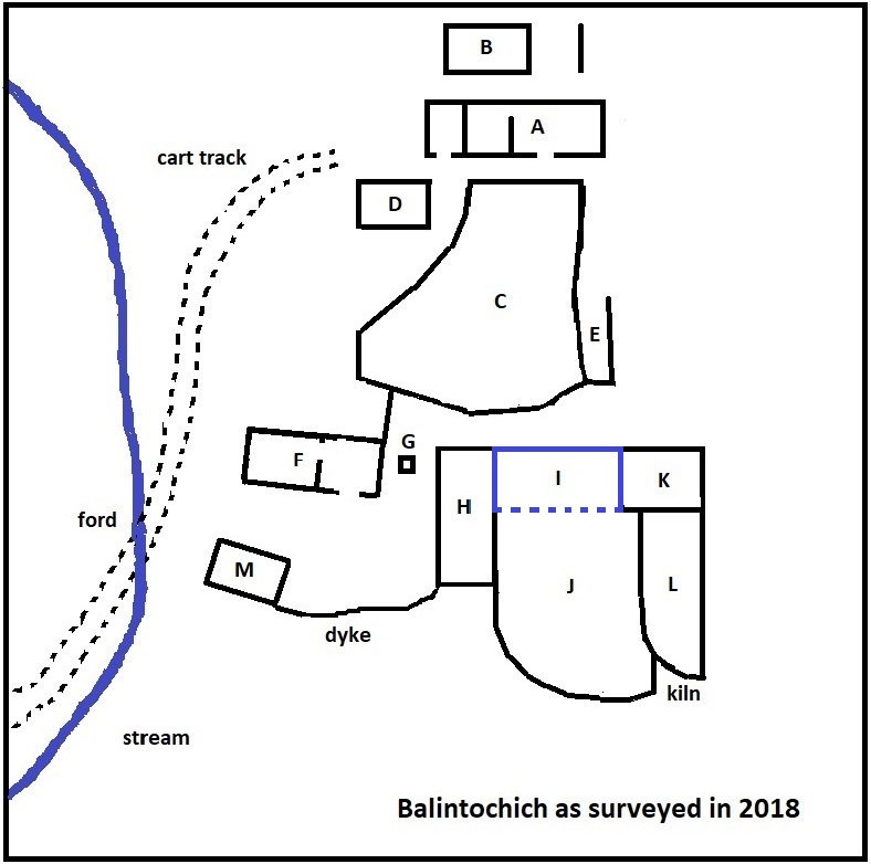
Building I is directly connected to the top end of the large barn (H) and runs east-west for about 12 metres, being about 5 metres in width.
The 1867 O.S. map shows this structure merely as a wall on the south side running between buildings H and K, with no wall on the north side.
This is strange as the wall is now at the north side with only a line of stones, like a small curb, on the south side. To the south of this
curb the ground slopes down the hillside as a stone walled enclosure (J).
Taken together, I and J may have been an open-sided stable with ajoining paddock.
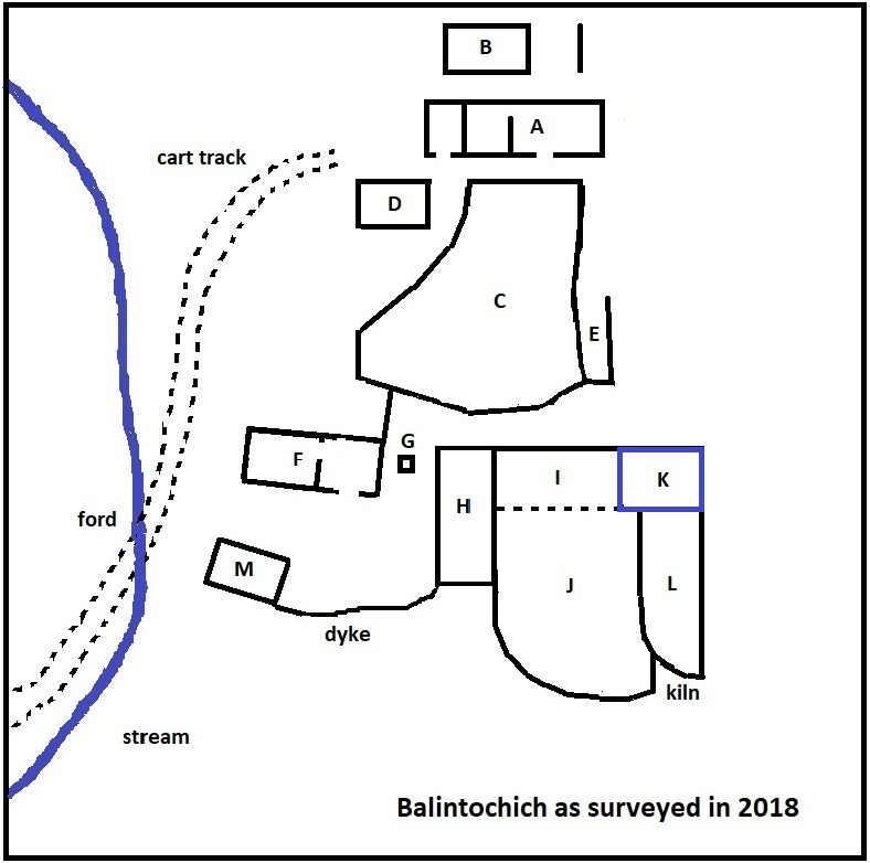
The third building in the range (K) is virtually devoid of stones compared to 'H' and 'I', and even the enclosure is just an outline. The reason for this is unclear. As the wall between enclosure 'J' and enclosure 'L' does not line up with the wall between structures 'I' and 'K', it can be inferred that the enclosures were built at a later date. Presumably the site was then robbed to provide stone for another structure in the settlement. This end of the range is very close to the edge of the ravine on the east side of Balintochich.
To the south of enclosure 'L' there is a hollowed depression on two levels with numerous stones on the surface. The Perth & Kinross Historic Environment Record for Balintochich (MPK 1240), describes the site as having "a corn drying kiln", and this is the only structure which might be identified as such. Even so, much of the previously seen kiln-bowl and barn footings must be covered with soil slippage or disturbed by animals grazing in this area.
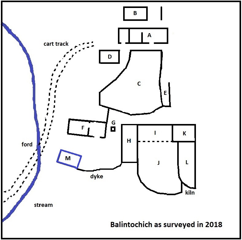
Building M is in a tumble down state and difficult to see in summer, due to the bracken. It would appear to be a small byre, store or workshed.
| Blair Atholl Marriages | Return to Home Page |
|---|