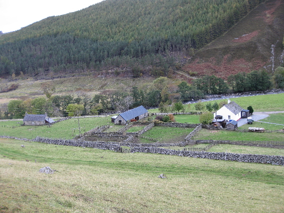
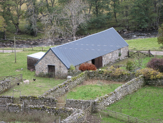
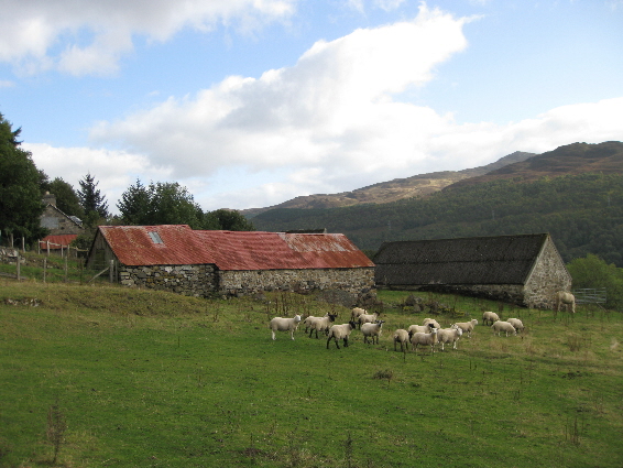
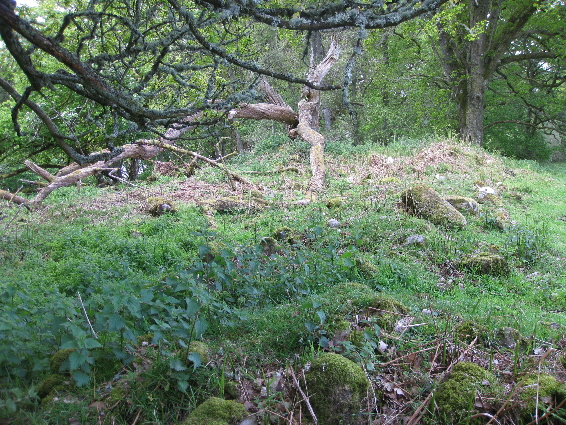
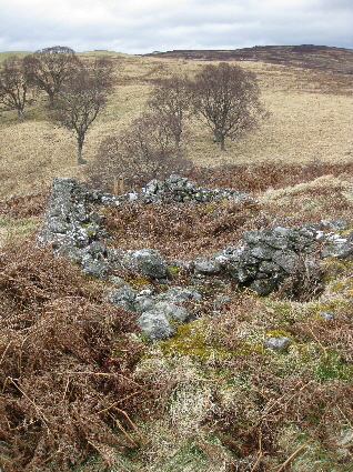
The Gazetteer on this website can show you where your ancestors lived, but sometimes it is nice to see the place and its surroundings, even if it is now just a pile of stones. Some homesteads have been rebuilt several times and bear little resemblance to the original crofts. Others have been completely destroyed by field clearance or by the building of motorways and railways. However some remain, hidden in the grass and bracken, a testament to previous times.
-
-
-
-
-
-
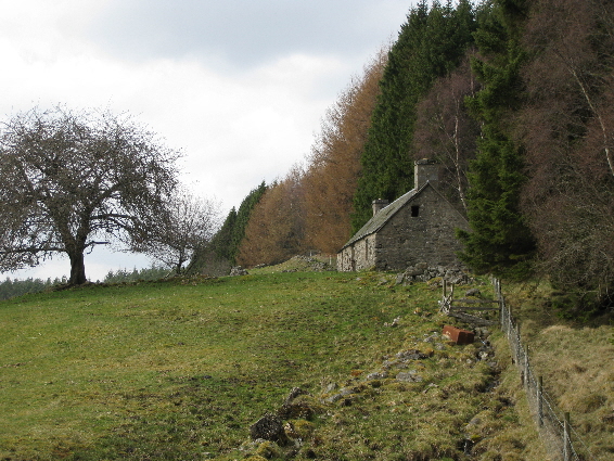
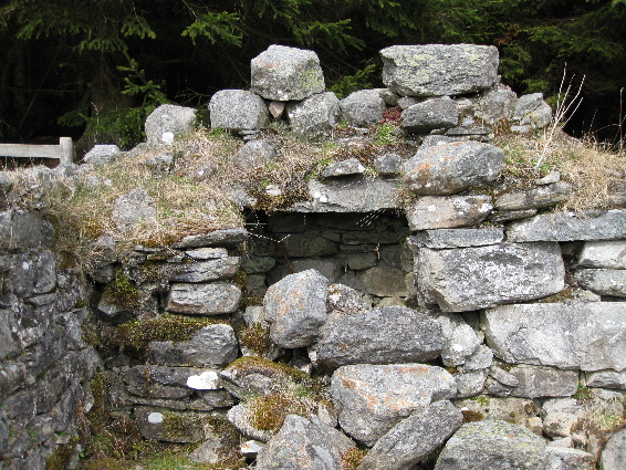
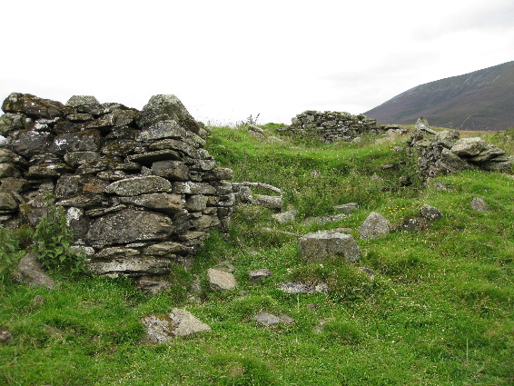
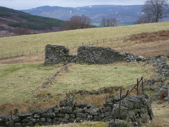
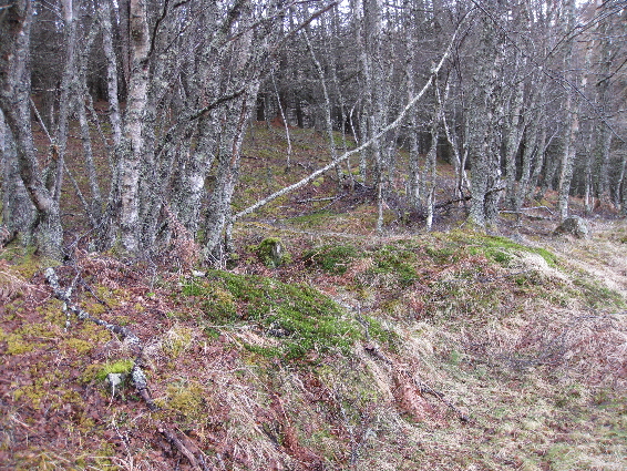
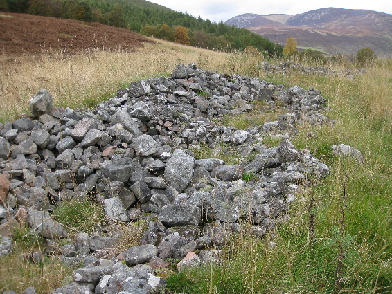
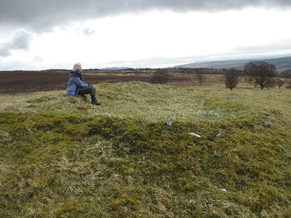
In 1802 Alltandubh was taken over by His Grace the Duke of Atholl and added to his sheep pasture in Glen Tilt. the farm was sown with clover and by 1808, when David Buist was drawing his map of the commonty, the settlement was in ruins. Currently there are the remains of at least eight buildings, one of which still has an intact gable end. The settlement also has the remains of a corn-drying kiln.
A more complete description of Apersuaine is available.
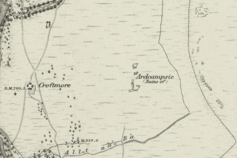
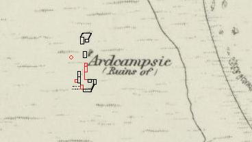
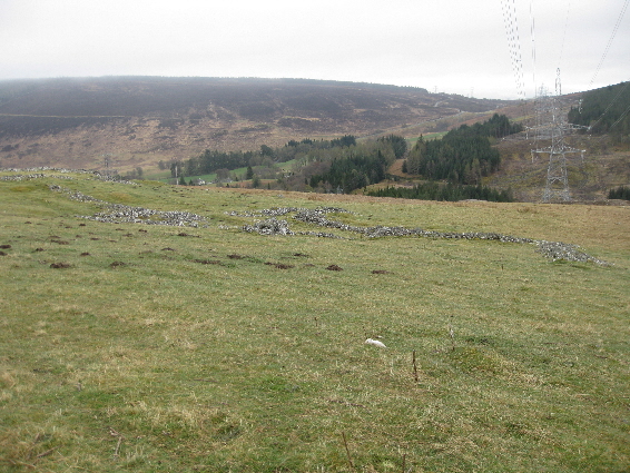
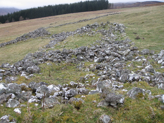
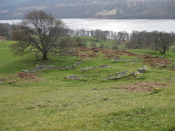
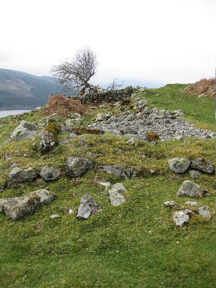
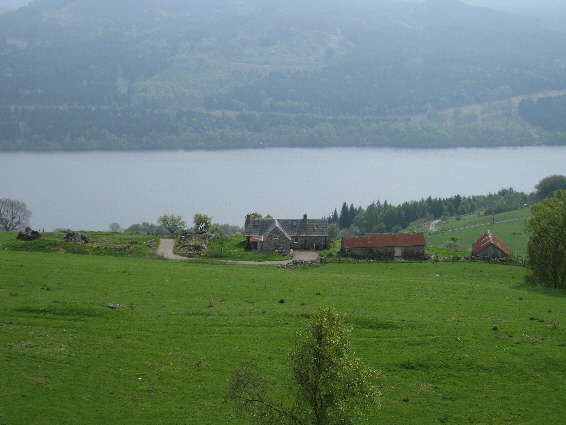
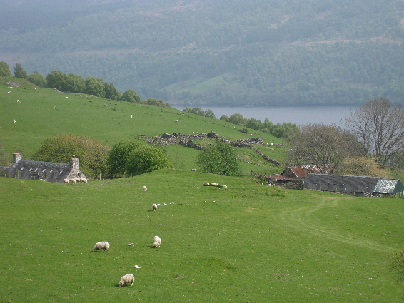
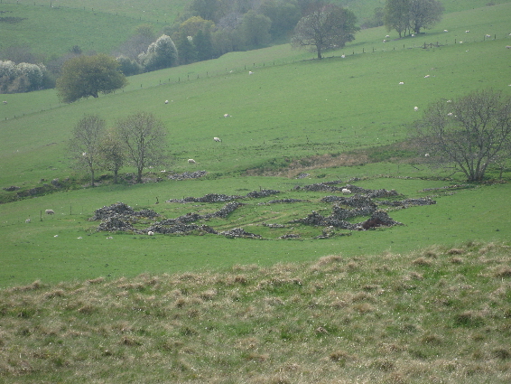
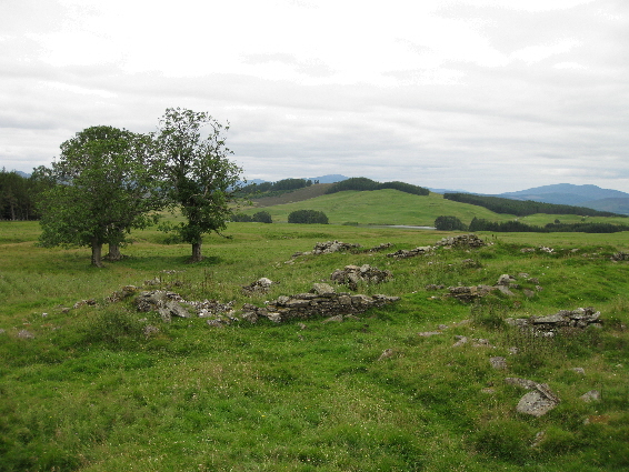
Ardcampsie is situated on the flat grassy plateau, to the east of Croftmore, and invisible from the road below. It is still possible to discern the outline of an upland track which passed Ardcampsie, running southwards to Blair Atholl and northwards to Dalginross.
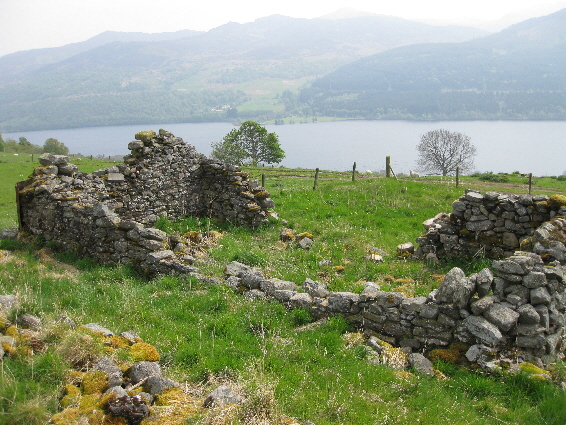
Even by 1867, when the surveyors were working on the 1st edition of the Ordnance Survey map of the area, Ardcampsie was in ruins. One of the last time that it is mentioned in the Old Parish Records, is when Donald McDonald in Over Campsie married Elizabeth Stewart of Invervack (17th Jul 1797). Ardcampsie was divided into Nether Campsie and Over Campsie. In December 1791 the OPR shows that Janet McLauchlan was married while living at Nether Campsie, and both John Robertson and Katherine Shaw were living at Over Campsie when they married each other.
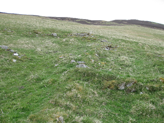
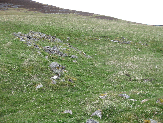
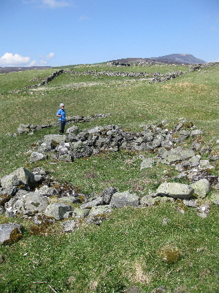
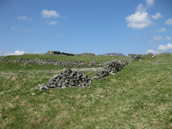
Like a number of other ruins in Blair Atholl, Ardcampsie contained more buildings than were shown by the Ordnance Survey team. Perhaps they felt that, as the place had been in ruins for many years, the accuracy of what they were recording was not really important. The footings of an additional four more buildings can be seen (shown in red, above), as well as connecting walls turning the southern set of buildings into a quadrangle. There is also an interesting circular depression slightly to the west, between the houses and a natural outcrop. This may have been a scooped out pond to provide water as, although the ground in quite wet, the only running water is the Allt na Bà.
A more complete description of Auchdrumnahuagie is available.
Auchghoul is probably best known for the true story of Alasdair Stewart of Auchgobhal and the murder of McIntosh of Tirinie which probably happened around 1630.
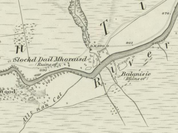
Balanisie (Pittenicy) or more correctly Pit an Easaidh is on the opposite side of the River Tilt from Dail Mhoraisd, and was shown as 'in ruins' in 1867 when the 1st edition of the Ordnance Survey map was being produced. This is not surprising as it was cleared in 1802 to make way for the Duke of Atholl's sheep pasture in Glen Tilt. The outline of the footings of several dwellings and the enclosure as easy to make out even now. The house in front of the enclosure must have been built after 1867, but is uninhabited and boarded up.
A more complete description of Balcastle and its history will soon be available.
A more complete description of Balchapel and its history is available.
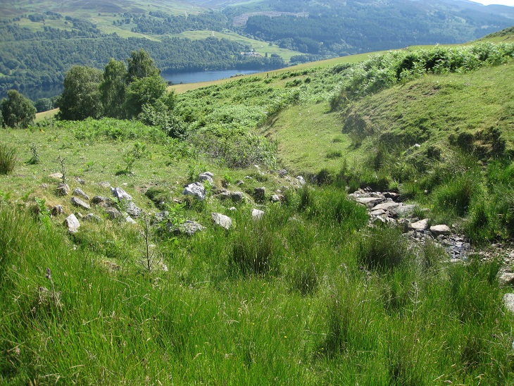
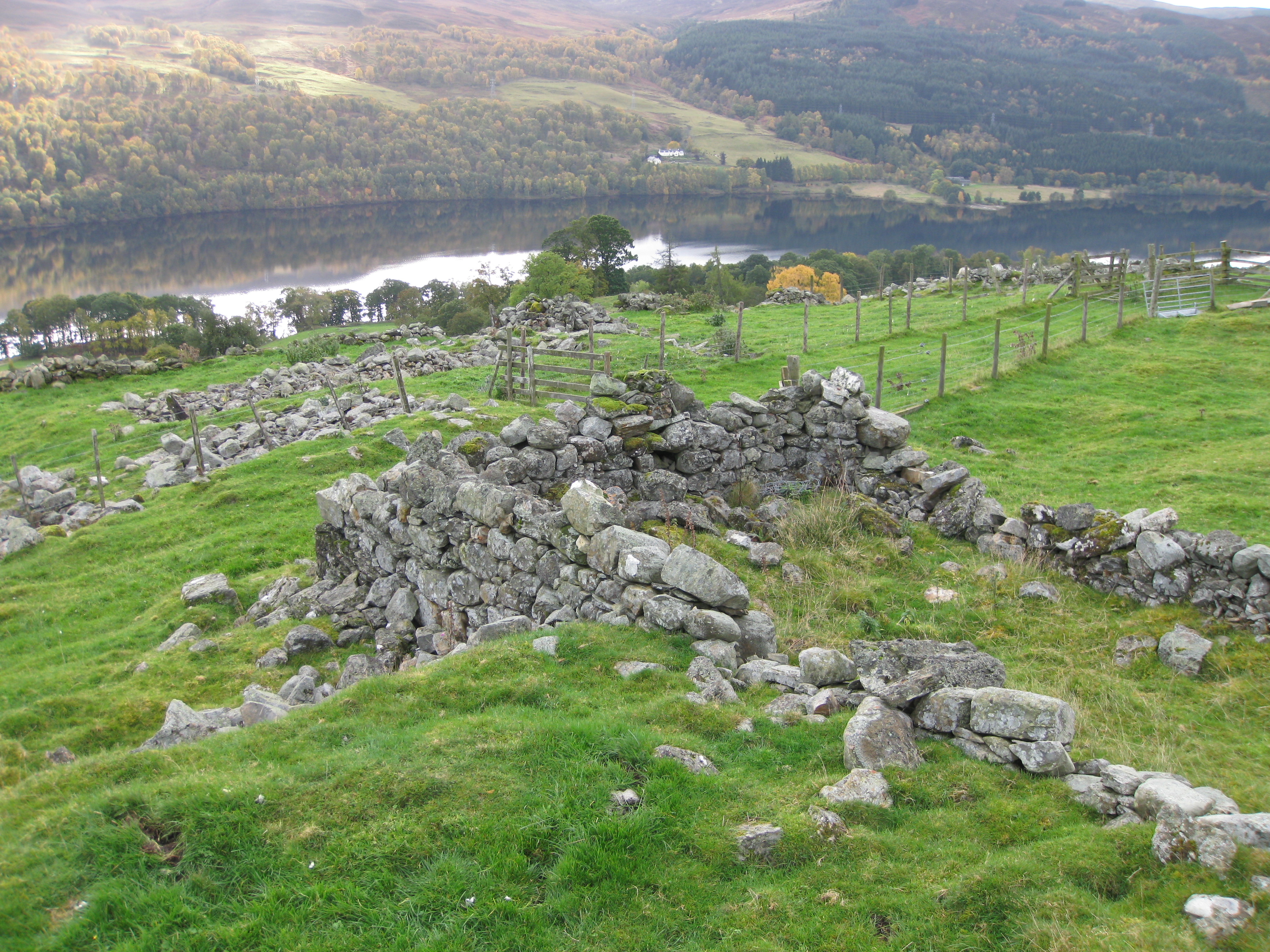
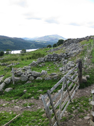
The homestead is situated on the hillside, just to the north of the Strathtummel road, above the present-day Borenich Farm (O.S. Grid Ref: NN 8369 6064). As can be seen from the photograph above, the location is quite exposed, with the remains of the buildings on a ridge of rough meadow between two streams. The Allt Borenich to the east forms a deep gorge making access from that direction difficult, and access was by a cart track which forded the river to the west, and led downhill to Knockgarry, where it met the hill-road. There is also the remains of a track above Balintochich which stops at the head dyke, and it is almost certain that originally it connected Balintochich to the hill road over to Blair Atholl.
A more complete description of Balintochich and its history is available.
The settlement of Balintuim currently consists of a private house, next to which are the ruins of the easterly dwellings. Compared to other ruins in this area, these are in much better condition than most, with large amounts of the walls and gable ends still standing. Most of the older buildings in Strathtummel appear top have been of a cruck-frame design, so these building may have been rebuilt in the early 1800s using the original stone footings.
The census returns from 1841 until 1901 show that there were two houses were in constant use. The McDonalds occupied one dwelling and the other was home to the Dows, and then the Robertsons. There is a monument inscription to this latter family in the Struan churchyard.
A more complete description of Balintuim and its history will soon be available.
Some of the old buildings at Balnabodach have been renovated and are private houses. To the east of these private buildings there are extensive ruins of dwellings, out-houses and enclosures.
A more complete description of Balnabodach and its history will soon be available.
A more complete description of Balnald and its history is available.
A more complete description of Balnauld and its history is available.
A more complete description of Blairbuie and its history is available.

A more complete description of Breakach of Glengirnnaig is available.
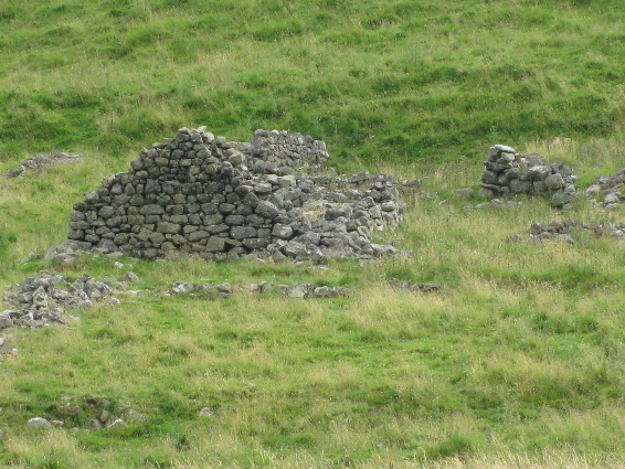
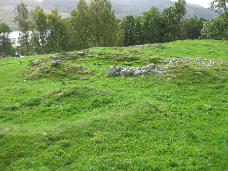
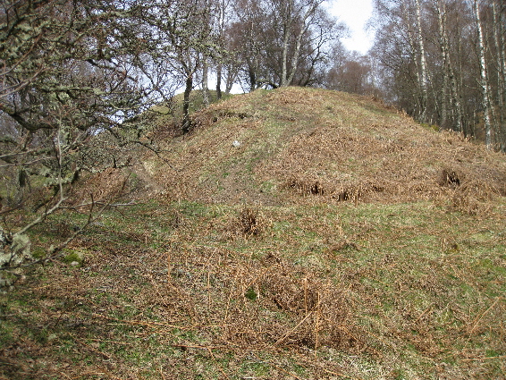
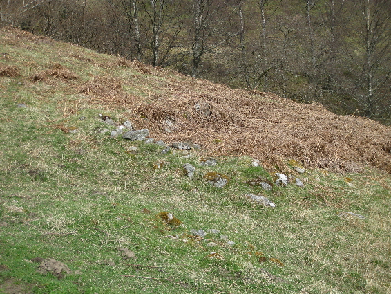
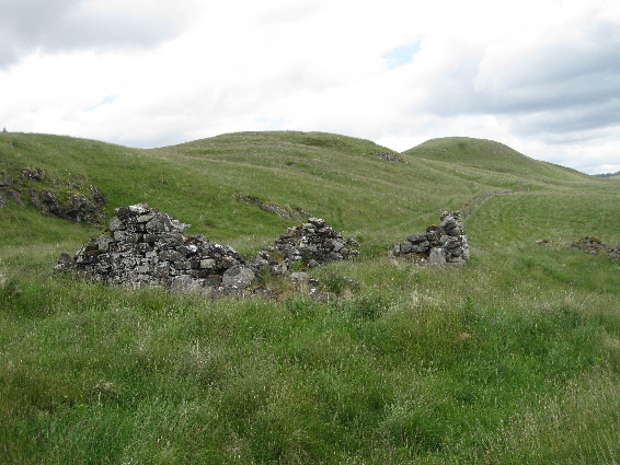
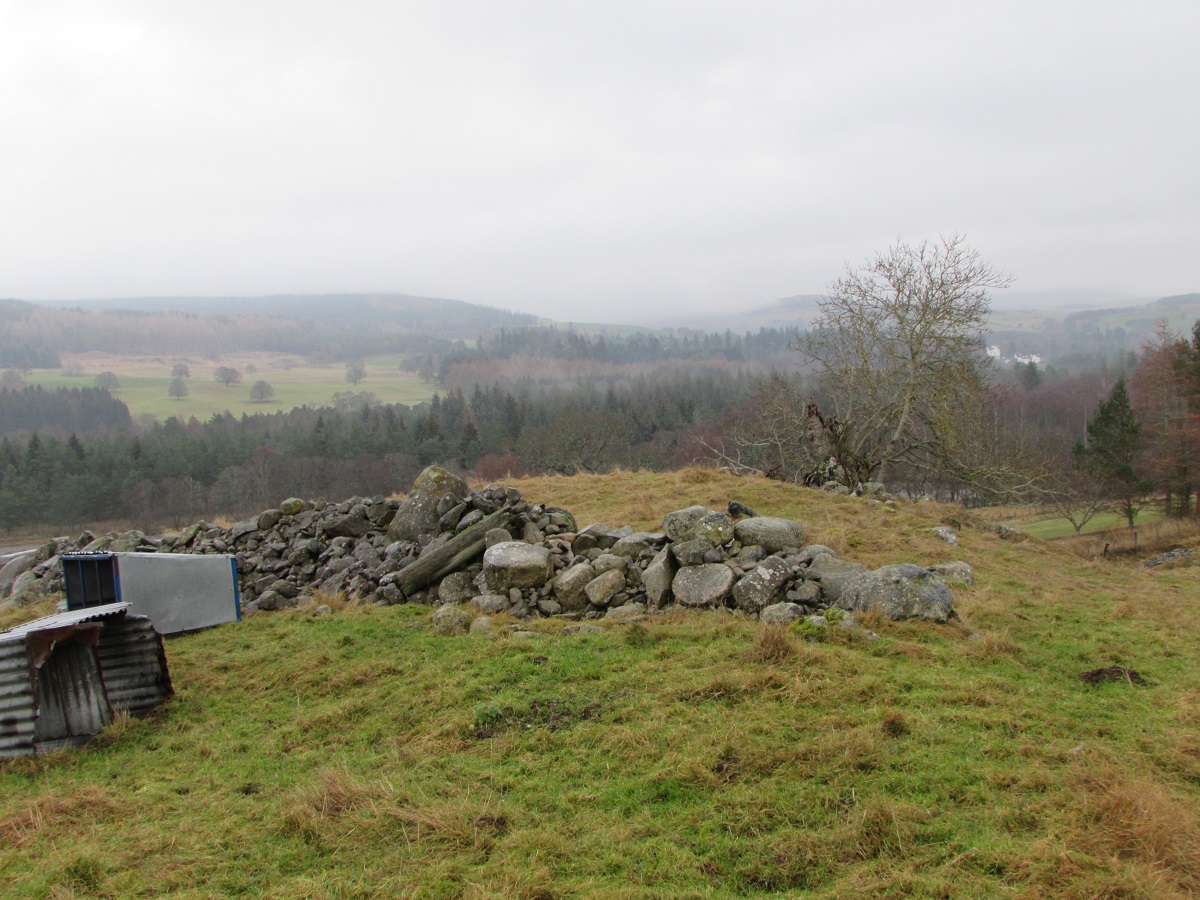
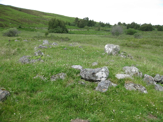
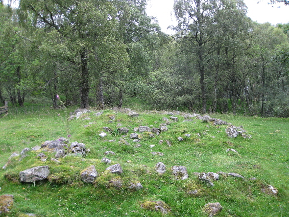
The ruins of Cairnbaddie are to the north of Loch Moraig, which is an artificial loch produced by an earthen banking at the south end of a previously boggy area. The footings of several dwelling are still clearly visible beside a clump of three trees which probably date from the time of habitation. One of the buildings, shown on the right, has been constructed on two levels. The propose for this is unclear, but the lower part built into the banking might have been cooler, making it suitable as a store for milk and cheese.
Carrick (Carrig) is at the top of Glen Fincastle which is mostly in the parish of Dull, but Carrick is in Blair Atholl parish
(and the quoad sacra parish of Tenandry by 1861).
This singular location probably explains why neither parish enumerator visited this settlement to record the 1841 census data.
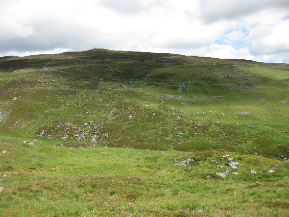
At about 1,000 feet up, Carrick overlooks Invervack and Bruar, and nestles behind Tulloch with a limestone outcrop and pavement
to the north.
In 1967 there were said to be the visible remains of no fewer than 12 buildings as well as a lime-kiln and a well, or spring.
However, as now, there were the substantial ruins of only one house which was probably a game-keeper's house before being
unoccupied by 1861. The remains of a lime-kiln can still be seen as well as the spring coming out of a metal spout protruding
from the limestone rockface.
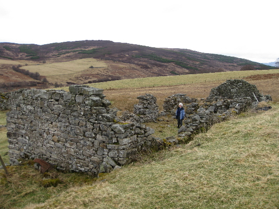
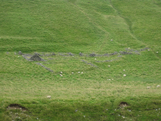
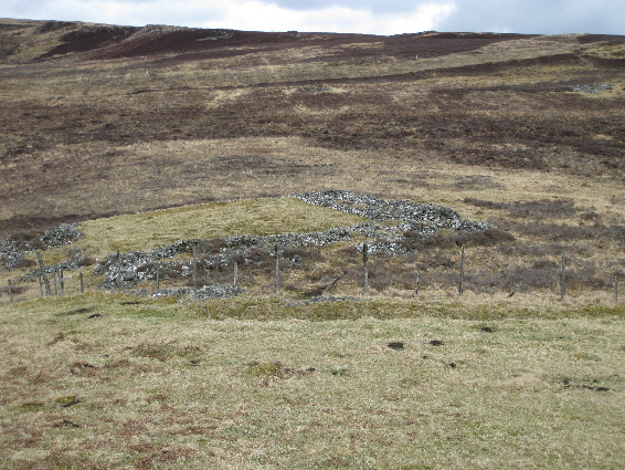
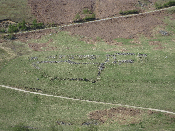
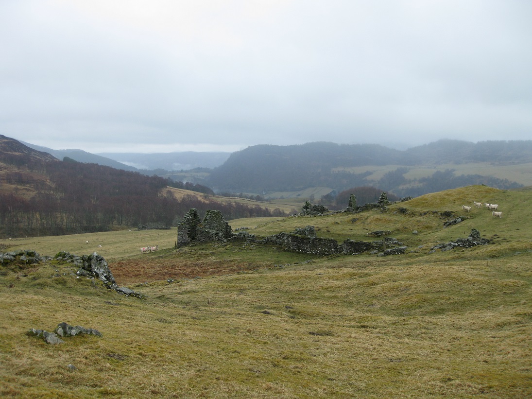
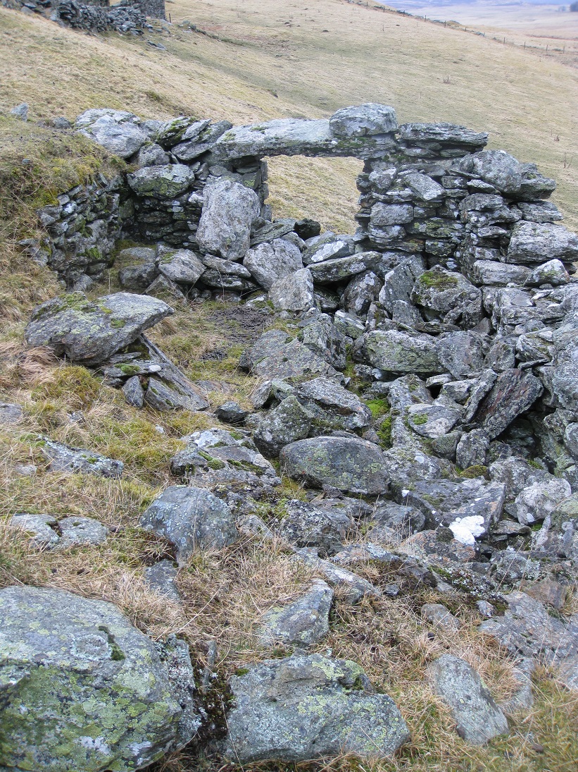
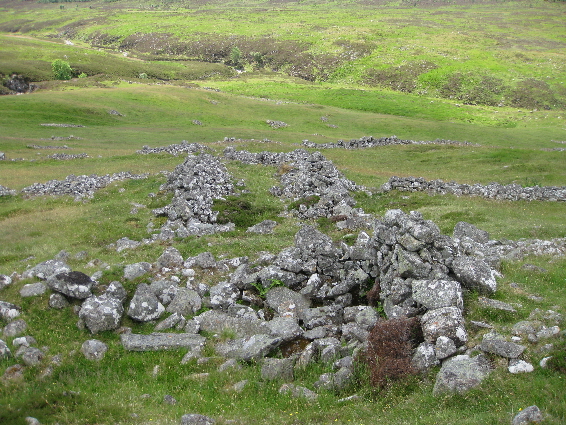
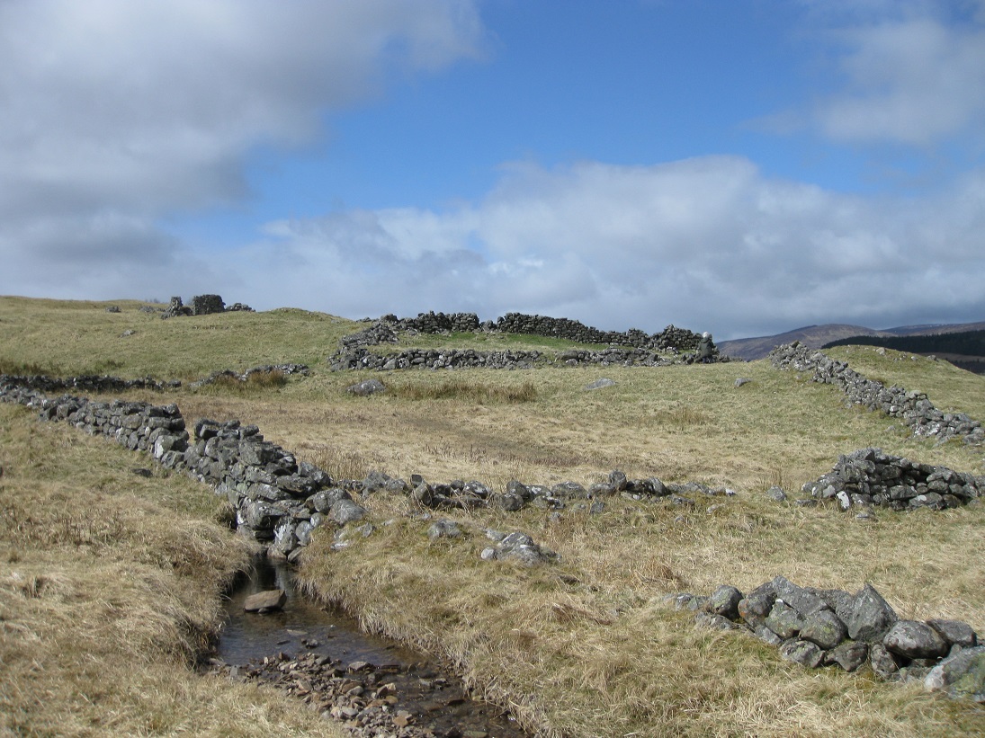
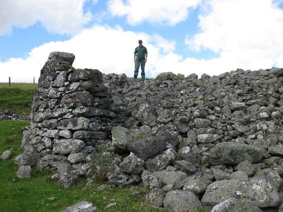
The 1867 First Edition of the Ordnance Survey for Perthshire shows two inhabited buildings at Clunes, together with enclosures, a sheep fold and a nearby ruin. The inhabited building were built at right angles to each other, and are situated just to the south of General Wade's military road. Both buildings were substantial with evidence of a large fireplace, and a stone buttress to support a wooden staircase in the north building. Beside the sheep fold appears to be the remains of an enormous lime kiln. Directly behind the north building is the footing of an earlier dwelling, and further up the hill are more stone footings which are not recorded on the O.S. map.
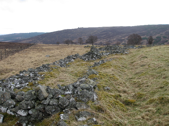
A head dyke separating the pastures from the moorland, runs roughly northwards from Clunes until it reaches the Allt nan Cuinneag. At this point there are three groups of ruins. The most southerly is comprised of a sheepfold with two rough stone footings at the north end and the footings of probably an outhouse at the south end. The middle group consists of the footings of two houses facing each other with an enclosure between. The most northly group appears to be the footings of a single dwelling with a separate outhouse. None of these ruins are named and may be just part of the Clunes property.
A more complete description of Croftdouglas and its history is available.
Dalginross cannot be seen from the road along Glen Tilt, but a hill track just to the north of Croftmore takes you up to a fertile undulating plateau where Dalginross straddles the Croftmore Burn. On the south side of the burn the track winds between the footings of five cruck-framed houses before reaching the ford which connects it to the northern part of the settlement. On the far side of the burn there is a large enclosure which was still in use in 1867, when the First Edition of the Ordnance Survey map was produced. At that time a dwelling and an out-house were also both in use. The little that remains of the dwelling shows that it was un-mortared and constructed of uncut stone. The buildings to the north of the house have extended and rebuilt to form an animal enclosure, and the out-house has been used as an animal pen in the last fifty years or so.
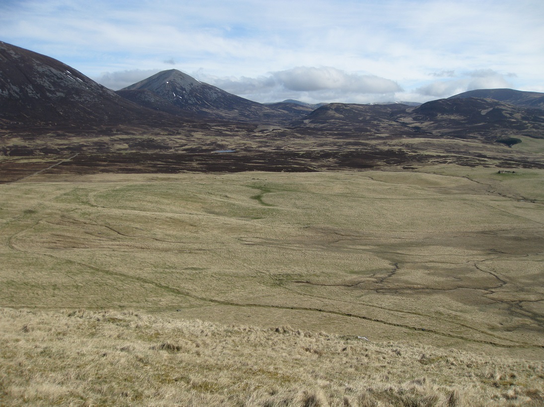
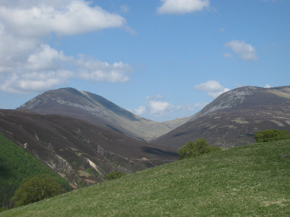
Being so high up, Dalginross must have been a bleak place to live in winter, but in summer the grazing must have been excellent and the view to the north is just stunning!
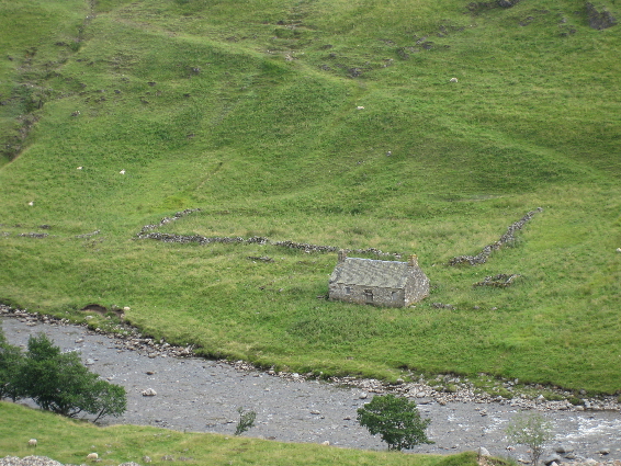
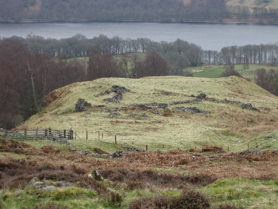
Dalvorest is a corruption of Dail Mhoraisd, and Slochd can mean a pass or a slot. In this case it probably means a slot, as this large settlement was situated on the north side of the River Tilt just below the narrow entrance to Glen Cruinnich. The Allt Cruinnich joins the Tilt with some force at this point, and at some time in the past the force of the water has taken away the bridge and deposited stones from the river over much of the site. Luckily the inhabitants had long since gone, since this settlement was shown as 'in ruins' in 1867 when the 1st edition of the Ordnance Survey map was being produced.
As well as the houses by the riverside, there are the footings of more buildings higher up the hillside which are not shown on the O.S. map. One of these can be seen in the photograph above.
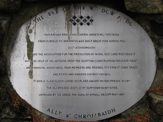
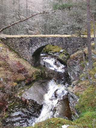
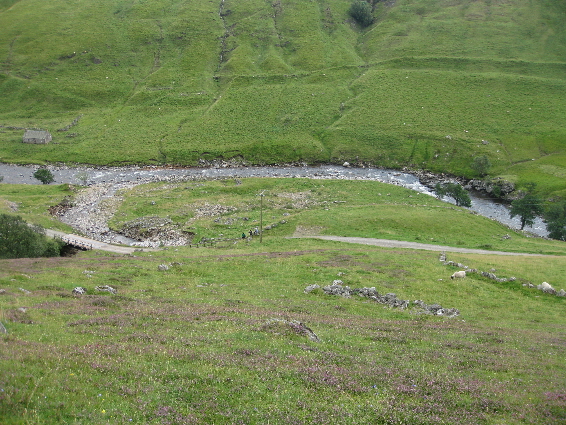
A mile or so from Calvine, General Wade's military road descends steeply to cross the Allt a' Chrombaidh gorge by a spectacular military bridge called Drochaid na h-Uinneige (the Eye of the Window). On the east side of the bridge is the quarry which provided the stone for the original construction. By the late 1970s, the bridge was reported as being in a serious state of disrepair and on the verge of collapse. It was restored by the Association for the Protection of Rural Scotland in 1985.
The First Edition of the Ordnance Survey map (1867) shows neither the military road nor this bridge crossing the gorge. Instead it shows Drochaid na h-Uinneige as a bridge on the main road where it crosses the Allt a' Chrombaidh, but situated much further downstream, where it is about to join the river Garry. The census entries referring to Window Cottage probably relate to the two dwelling on either side of this lower, and newer bridge.
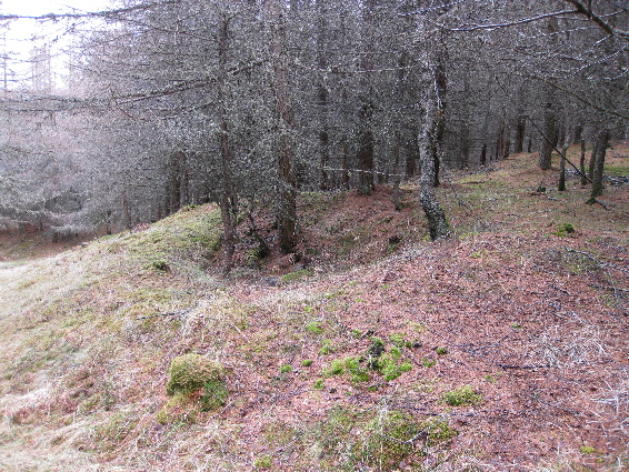
The outline of footing for two dwelling can be seen on either side of Drochaid na h-Uinneige. Both are very overgrown with grass, moss and birch trees. Whether these were in constant use, or temporary shelter for the bridge builders, is unknown.
A more complete description of Glaicneid and its history is available.
The settlement of Inverslanie is on a grassy plateau to the left of the track up Glen Tilt, and just north of Crombie Wood. The First Edition of the Ordnance Survey map (1867) shows little detail of Inverslanie, and standing amongst the ruins surrounded by long grass, it is difficult to make out the structure of the settlement. However, viewed from the other side of the glen, high above Dalginross Wood, the layout becomes much clearer.
On the east side, facing the river, there is an extensive enclosure with the remains of a track leading northwards from it. Behind the enclosure are the footings of several cruck-framed dwellings and out-houses which run in a line from north to south. At the end of the settlement there are two further enclosures which might have been vegetable gardens.
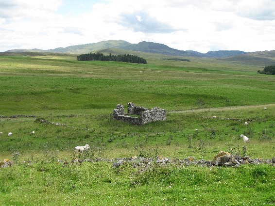
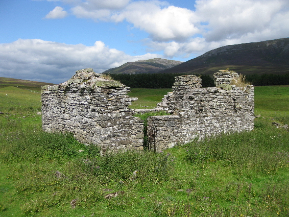
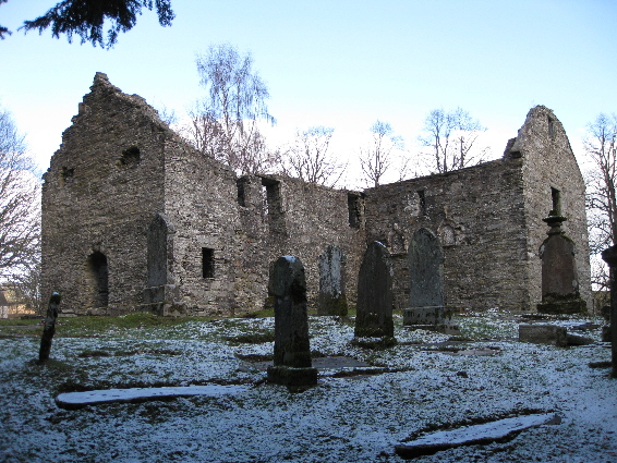
The abandoned church at Kirkton of Lude is surrounded by a rectangular perimeter wall showing the boundaries of the old graveyard. There are no memorial stones visible, but it is possible that flat slab stones are buried beneath the grass.
The ruins of this homestead are quite extensive and probably date from a re-building in the 1800s. Although there is the outline of a small house at the front, the biggest ruin is a long farm range with a side arm at either end and a central courtyard. This extensive steading has been built into the side of the hill and has thick walls. Surprisingly, they are not mortared. There also seems to be a sheep fank close by, as well as the remains of enclosures for growing vegetables.
A more complete description of Knockgarry and its history will soon be available.
Loinn Mheadhonach (NN 7099 6178) was in Fortingall parish, but has been included as it is mentioned in the Blair Atholl register of marriages.
The 1st edition of the Ordnance Survey map (1867) shows Loinn Mheadhonach as a collection of ruins to the west of Mullinavadie and Bohespic. A few years later a new road was constructed between Trinafour to Kinloch Rannoch, but instead of following the old track past Mullinavadie, the new road was build just to the west of Loinn Mheadhonach.
The current O.S. map shows no trace of the dwellings, and only a few of the stone footings for cruck-framed houses still exist at the site.
Loinn Mhor (NN 7079 6134) was in Fortingall parish, but has been included as it is mentioned in the Blair Atholl register of marriages.
The 1st edition of the Ordnance Survey map (1867) shows Loinn Mhor as a collection of ruins to the west of Mullinavadie and Bohespic. This survey was carried out before the construction of the road from Trinafour to Kinloch Rannoch, which runs to the west of the site. On the current O.S. map the site is marked by a cairn, but this appears to be the result of recent field clearance being deposited on the remains of Loinn Mhor. In fact little can be seen of the footings of the dwellings which have been covered by bracken, and it would have been unusual to have dwellings next to a real cairn.
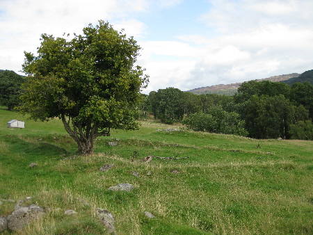
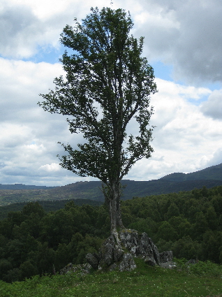
Close to the dwellings is a remarkable rowan tree which is growing out of a boulder. The tree has its roots growing out of a crack in the and over the side of the rock. The tree appears to be very old and may have been growing in the same position when Loinn Mhor was inhabited. Perhaps it was even protected as rowan trees were thought to ward off witches and evil spirits.
There are two homesteads called Markdou (Margdow): Markdou of Clune and Margdow of Invervack.
A more complete description of Markdou of Clune and its history is available.
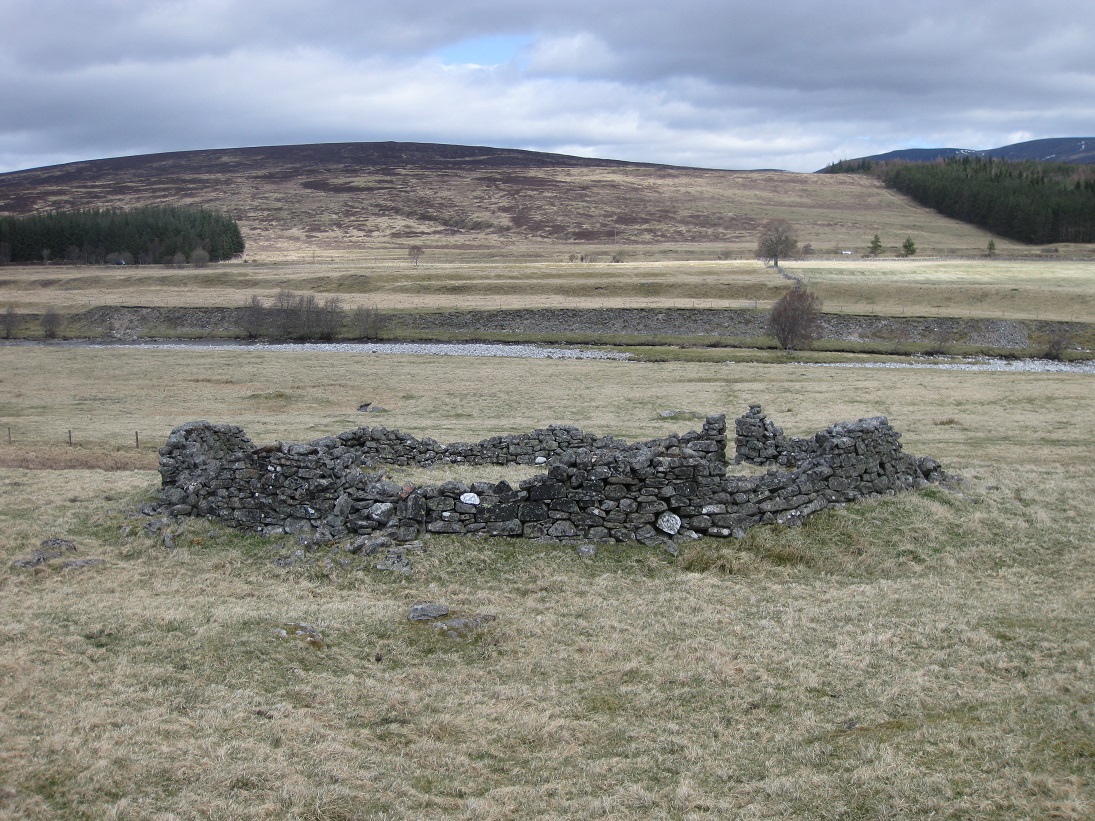
Milltown of Borenich was formerly known as Laightown and also Netherton of Borenich.
A more complete description of Milltown of Borenich and its history is available.
A more complete description of Riechappel and its history is available.
A more complete description of Tomanbuie and its history is available.
A more complete description of Tomicaldonich and its history is available.
Tomnasallan is not shown on the First Edition of the Perthshire Ordnance Survey map (1867). It is shown on James Stobie's 1783 map, situated on the north side of General Wade's military road as it crosses the Allt nan Cuinneag. The footings of a dwelling on the slope above the river are easily seen despite the bracken, and another footing on the open ridge slightly to the east are also visible. Bill McMillan was paying £320 rental to the Duke of Atholl in 1820, for the Clune and Tomnasallan grazing. He was soon in arrears and, being a difficult man to deal with, the Duke's factor decided to confiscate before McMillan could remove his livestock.
A more complete description of Uchdnanetaig and its history is available.
| Return to Home Page |
|---|